Rock Fire
https://ready.inyocounty.us/pages/rock-fire
https://www.fire.ca.gov/incidents/2026/7/20/rock-fire
https://app.watchduty.org/i/109982
Highway 395, Just Southeast of Aberdeen
Inyo County, CA
Acres: 12,008.4
Containment: 97%
Evacuation Notes
Administration Unit
Unified Command: CAL FIRE San Bernardino Unit, California Highway Patrol, Inyo National Forest and the Inyo County Sheriff’s Department
Cause: Under Investigation by CAL FIRE Law Enforcement
August 3, 7:27 AM
From Watch Duty:
The fire is now 97% contained, per CAL FIRE.
—
August 3, 7:20 AM
From Watch Duty:
All remaining Evacuation Orders and Warnings have been lifted. All zones have been returned to Normal status. – per the Genasys Evacuation Map
—
August 2, 5:58 PM
From Watch Duty:
The fire is now 95% contained, per CAL FIRE.
—
August 2, 8:17 AM
From Watch Duty:
The fire is now 94% contained. Firefighters continue to strengthen containment lines, extinguish remaining hotspots, and repair areas impacted by suppression efforts. Crews remain committed to securing the fire and increasing overall containment, per CAL FIRE.
—
August 1, 6:23 PM
From Watch Duty:
The fire is 92% contained, per the National Interagency Fire Center (NIFC).
—
August 1, 10:59 AM
From Watch Duty:
Current Situation: The Rock Fire and Cinder Complex have very little fire activity. As afternoon winds pick up, sand and ash may be seen blowing around the fire area. Crews are still working in the area, strengthening containment lines to 500 feet within the fireline. They are backhauling hose, flagging, and other fire equipment that has been in use since the fire began. Firefighters are continuing to practice excellent safety measures during the final stages of the incident.
Weather: Conditions across the area remain hot and dry with temperatures reaching triple digits. In the afternoon, wind gusts could reach up to 25mph. No thunderstorm activity is expected. These conditions are expected to last through at least mid-week.
Per the U.S. Forest Service – Inyo National Forest Facebook page.
—
August 1, 8:22 AM
From Watch Duty:
The fire is now 90% contained, per CAL FIRE.
—
July 31, 9:55 AM
From Watch Duty:
The fire is now 88% contained, per CAL FIRE.
—
July 31, 8:50 AM
From Watch Duty:
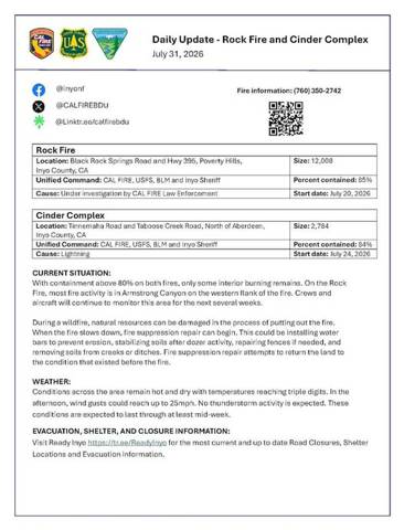
On the Rock Fire, most fire activity is in Armstrong Canyon on the western flank of the fire. Crews and aircraft will continue to monitor this area for the next several weeks.
Update from U.S. Forest Service – Inyo National Forest on Facebook
—
July 30, 5:39 PM
From Watch Duty:
The fire is now 85% contained, per CAL FIRE.
—
July 30, 12:37 PM
From Watch Duty:
Current Situation 7.30.2026
Fire activity on the Rock Fire has been minimal. Firefighters are building containment line and fire suppression repair is in process. People in the area should be aware that smoke within the interior of the fires could still be visible for several months due to inaccessible terrain for firefighters. The fire will continue to be monitored.
Per the U.S. Forest Service – Inyo National Forest Facebook page.
—
July 30, 11:36 AM
From Watch Duty:
The fire is now 84% contained – per CAL FIRE
—
July 29, 7:26 PM
From Watch Duty:
Evening Update for 7/29 from Inyo National Forest on Facebook:
Smoke continues to be visible from the Rock Fire in the Armstrong Canyon area and may be seen from Highway 395. Smoke may persist for several months as large trees—some measuring seven to eight feet in diameter—continue to smolder within the fire’s perimeter.
Armstrong Canyon is characterized by extremely steep, rough and rugged terrain. Inserting firefighters into the canyon would expose personnel to significant hazards, including unstable footing, falling trees and rolling debris. For the safety of firefighters, water-dropping helicopters are currently the safest and most effective method for suppressing the remaining heat.
Regular reconnaissance and infrared flights allow fire personnel to identify heat sources and confirm that smoldering material remains within the established perimeter without causing additional fire spread.
The Inyo National Forest remains committed to achieving full suppression of the Rock Fire. Fire personnel will continue monitoring conditions and using the most appropriate ground and aerial resources until suppression objectives are met.
—
July 29, 5:29 PM
From Watch Duty:
The fire is now 79% contained, per CAL FIRE.
—
July 29, 12:22 PM
From Watch Duty:
The following changes to evacuations have been made for the Rock Fire/Cinder Complex. Updated zone statuses are visible on the Watch Duty map and the Genasys Evacuation Map:
Zones ICU-123-C & ICU-123-D have decreased in size, but Evacuation Orders remain for these Zones.
Zones ICU-123-F & ICU-123-E have been created and are now under an Evacuation Warning. (These Zones were split from Zones ICU-123-C & ICU-123-D).
Evacuation Warnings for Zones ICU-117-C & ICU-129 have been lifted.
—
July 29, 10:17 AM
From Inyo National Forest:
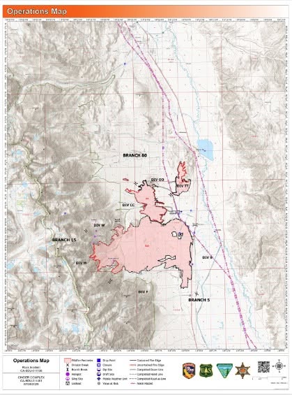
The #RockFire remains 12,008 acres and is now 74% contained. Control lines continue to be strengthened as firefighters continue to mop-up any areas of heat. Crews continue to work on suppression repair of firefighting activities.
The #CinderComplex remains 2,784 acres and is now 51% contained. Firefighters continue to strengthen control lines and mop-up remaining sources of heat.
Firefighting efforts are currently ongoing, even as roads re-open. The public is urged to use caution while driving in these areas. Drive with your lights on and use caution. Firefighting trucks are heavy and take longer stopping distances.
For the latest information on road closures and evacuation statuses, please visit Ready Inyo (https://ready.inyocounty.us/pages/rock-cinder ).
—
July 28, 7:06 PM
From Watch Duty:
Evening Update per Inyo National Forest on Facebook:
Current Situation: Crews assigned to the Rock Fire and Cinder Complex continue mopping up and strengthening control lines in challenging terrain. Effective suppression tactics are expected to keep both fires within their current footprints. Fire personnel remain on scene and will continue identifying and extinguishing hot spots within the fire perimeters.
Weather: Conditions across the area remain hot and dry with temperatures reaching triple digits. In the afternoon, wind gusts could reach up to 25mph. No thunderstorm activity is expected. These conditions are expected to last through at least mid-week.
—
July 28, 6:26 PM
From Watch Duty:
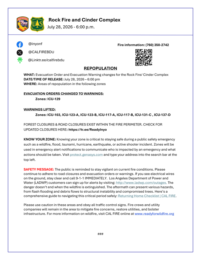
The following changes to evacuations have been made for the Rock Fire/Cinder Complex. Updated zone statuses are visible on the Watch Duty map and the Genasys Evacuation Map.
Zone ICU-127 has been split into ICU-127-A & ICU-127-B. Zone ICU-127-B (Aberdeen) has been downgraded to a Evacuation Warning. ICU-127-A remains under an Evacuation Order.
The Evacuation Order for Zone ICU-131-C has been lifted.
Zone ICU-129 has been downgraded from an Evacuation Order to an Evacuation Warning.
Evacuation Warnings have been lifted for the following Zones: ICU-123-B, ICU-103, ICU-117-A, ICU-117-B, ICU-137-D, & ICU-123-A.
Per CAL FIRE BDU.
—
July 28, 6:07 PM
From CAL FIRE:
—
July 28, 5:27 PM
From Watch Duty:
The fire is now 71% contained, per CAL FIRE.
—
July 28, 12:17 PM
From Inyo National Forest:
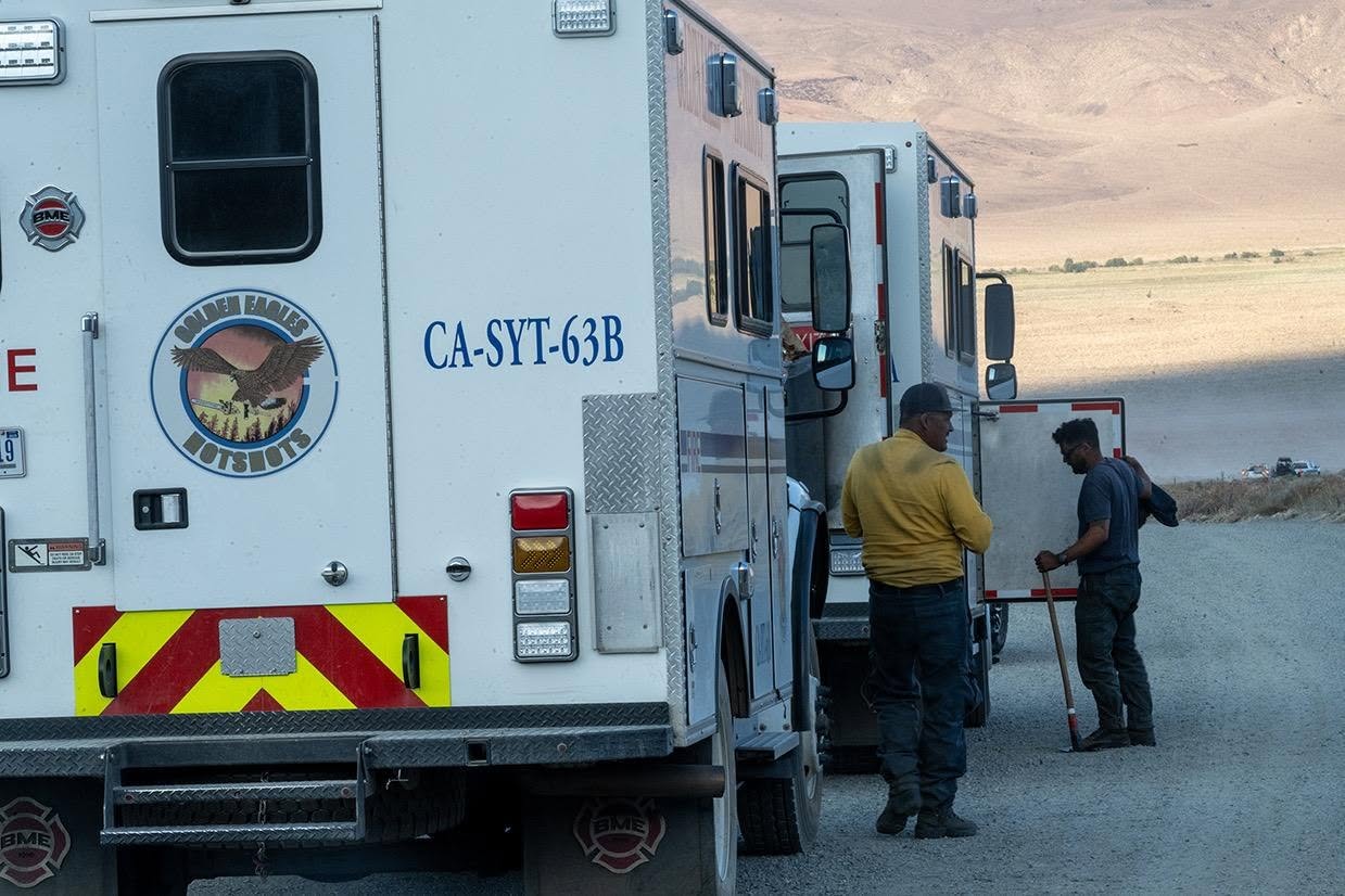
The #RockFire is 12,008 acres and is now 66% contained. Firefighters are continuing their work daily and working to hold and improve containment lines. As these lines are completed, containment of the fire will continue to increase. Crews are working to mop-up areas of heat 300′ in from the fire control lines. Currently, there are 564 firefighters assigned to the fire.
The Rock Fire is in Unified Command with CAL FIRE San Bernardino/Inyo/Mono Unit and the Inyo National Forest.
Information on evacuations, road closures, and shelters may be found at the Ready Inyo Office of Emergency Management page.
—
July 28, 11:20 AM
From Ready Inyo and Inyo County Sheriff’s Office:
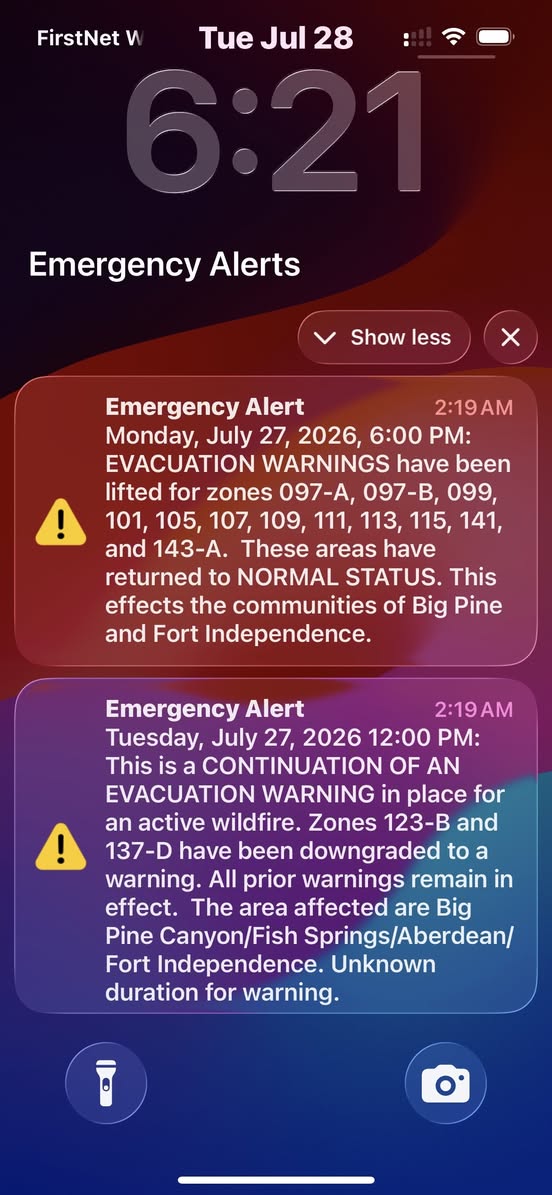
ALERT NOTIFICATIONS PSA
Monday afternoon, July 27, fiber optic lines were damaged by the Rock Fire/Cinder Complex, causing our emergency alert notifications to be sent out at different times throughout the day and night, depending on the cell phone carrier, user, and type of phones.
We sincerely apologize for the inconvenient alerts, and we appreciate your diligence in keeping up-to-date with what’s going on.
Please be advised: we will continue issuing daily renewals of the evacuation orders/warnings that remain in place due to legal requirement.
For the latest on Evac statuses, check the Genasys Protect App or website, or our Ready Inyo website:
Download the app: https://genasys.com/genasys-protect-app/
https://protect.genasys.com/en?lat=36.1716&lng=-115.1391…
https://ready.inyocounty.us/pages/rock-cinder
Additionally, you can call our fire information line at (760) 350-2747
—
July 28, 11:03 AM
From CAL FIRE:
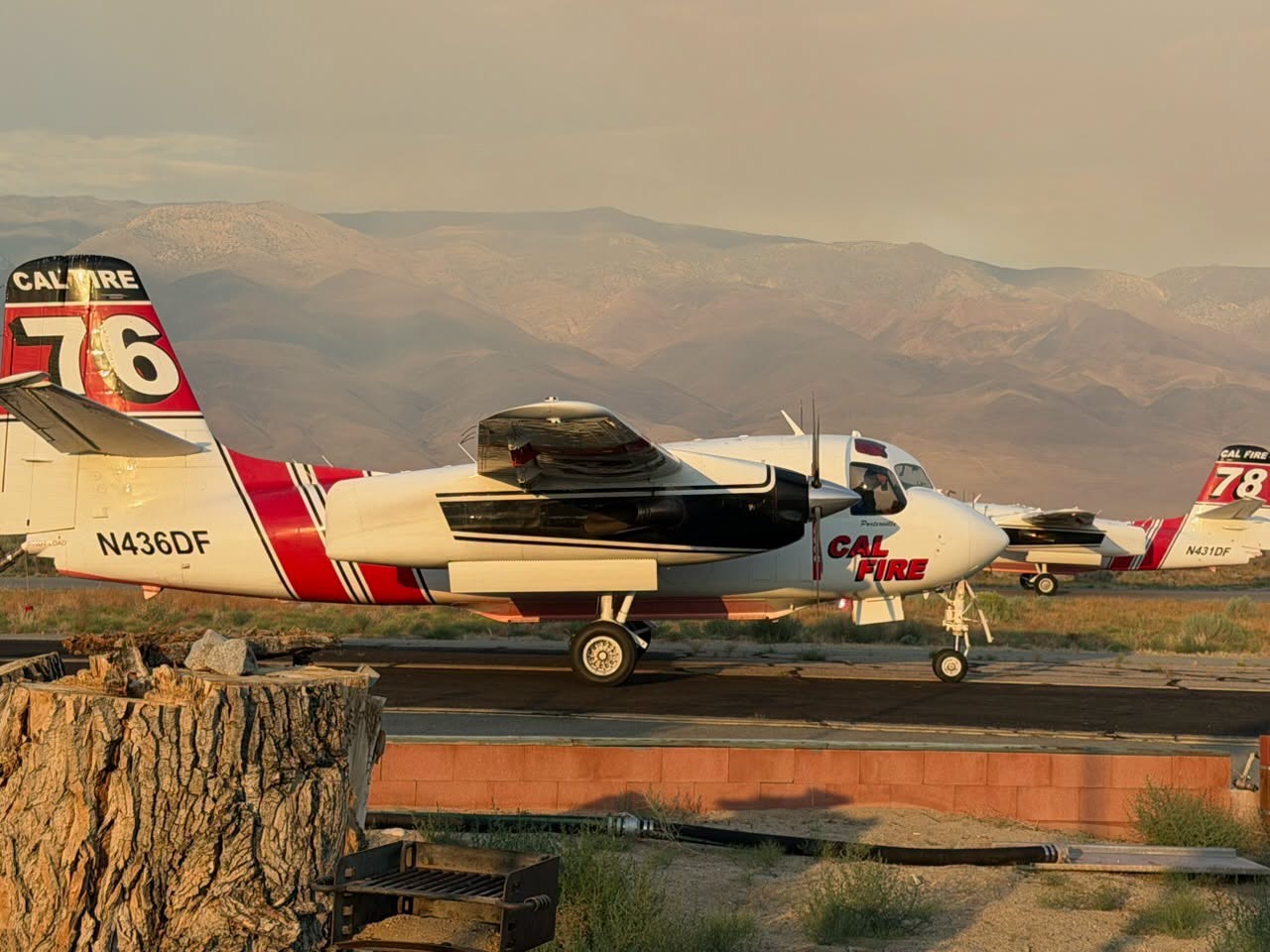
As air operations continue on the Rock Fire and Cinder Complex, a Mobile Retardant Base has been established at Bishop Airport through a joint effort between the Inyo National Forest and CAL FIRE.
The base allows fixed-wing airtankers to quickly reload fire retardant close to the incident, significantly reducing turnaround times between drops. Instead of traveling longer distances to reload, aircraft can spend more time over the fire supporting firefighters on the ground.
While Bishop Airport has long been identified as a potential airtanker reload location, this marks the first time since the 2015 Round Fire that a mobile retardant base has been activated here for fixed-wing airtanker operations. Its return highlights the scale and complexity of the current incidents and the importance of bringing aviation resources as close to the fire as possible.
This collaborative effort between the Inyo National Forest and CAL FIRE strengthens the region’s aerial firefighting capabilities, improving operational efficiency and helping firefighters respond more effectively to rapidly changing fire conditions.
—
July 27, 8:08 PM
From Watch Duty:
Rock Fire Update – 7/27
Size: 12,008 acres
Percent contained: 62%
Current Situation: There continued to be minimal fire activity across both the Rock Fire and Cinder Complex Monday. However, unconsumed fuels in the interior of both fires continue to smolder. Firefighters continue mopping up hot spots and patrolling for smoke. Fire suppression repair is underway.
Weather: Drier air remains across the region today, with RH dipping to around 10% and temperatures soaring into triple digits. No thunderstorm activity is forecasted through this week. This weather pattern is expected to last for several days.
Per the Inyo National Forest
—
July 27, 6:17 PM
From Watch Duty:
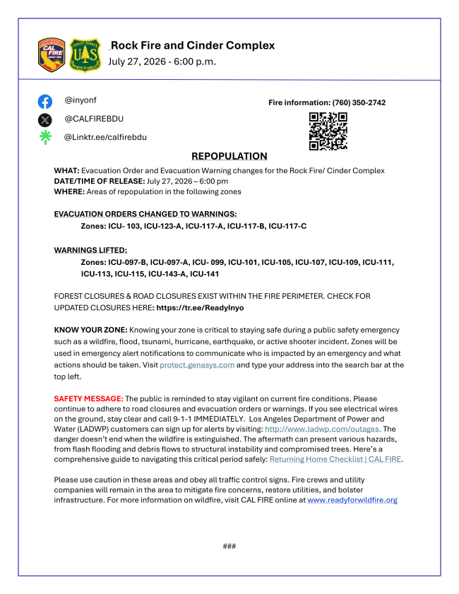
The following changes to evacuations have been made for the Rock Fire/Cinder Complex. Updated zone statuses are visible on the Watch Duty map and the Genasys Evacuation Map.
Evacuation Orders have been downgraded to Evacuation Warnings for the following Zones: ICU-103, ICU-117-A, ICU-117-B, ICU-117-C, ICU-123-A
Evacuation Warnings have been lifted for the following Zones: ICU-097-A, ICU-097-B, ICU-099, ICU-101, ICU-105, ICU-107, ICU-109, ICU-111, ICU-113, ICU-115, ICU-141, ICU-143-A
Forest closures & road closures exist within the fire perimeter. Check for updated closures at this link. Per CAL FIRE BDU.
—
July 25, 6:05 PM
From CAL FIRE:
July 27, 12:52 PM
From CAL FIRE:
—
July 27, 12:16 PM
From Watch Duty:
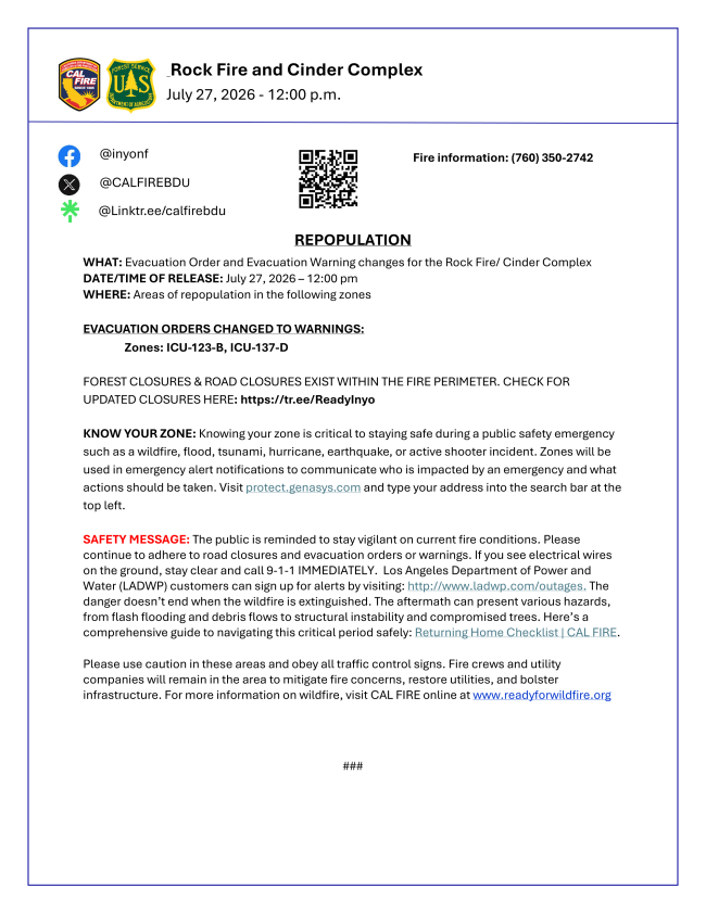
The Evacuation Order for Zone ICU-137-D has been downgraded to Warning.
This change may be viewed on the Watch Duty map or on Genasys Evacuation Map.
—
July 27, 12:06 PM
From Inyo County Sheriff’s Office:
Monday, July 27- 12 PM- Evacuation updates
The following evacuation zones will be downgraded from an EVACUATION ORDER to an EVACUATION WARNING:
ICU Zone 123-B- Big Pine Lakes, wilderness area
ICU Zone 137-D- NW of Fort Independence on the Westside of U.S. HWY 395
REMAINING EVACUATION ORDERS:
The following zones remain under EVACUATION ORDER due to ongoing safety hazards and continued assessments.
ICU Zones 103, 117-B, 123-A, 123-C, 123-D, 127, 129, and 131-C.
REMAINING EVACUATION WARNINGS:
The following areas remain under EVACUATION WARNING:
Community of Big Pine; ICU Zones 097-A, 097-B, 099, 101, 105, 107, 109, 111, 113, and 115; Fort Independence west of U.S. Highway 395 (ICU Zones 141 and 143-A).
Residents should monitor official updates and remain prepared for changing conditions.
Daily evacuation alerts may continue until ALL EVACUATION ORDERS and EVACUATION WARNINGS have been lifted.
For updated evacuation information or maps, please visit:
Genasys Protect: https://protect.genasys.com/…/37.143874%2C-118.418290…
WatchDuty: https://share.watchduty.org/i/110979?ts=1785176929000
Ready Inyo: https://ready.inyocounty.us/pages/rock-cinder
—
July 27, 6:12 AM
From Watch Duty:
The fire is now 56% contained, per CAL FIRE.
—
July 26, 7:02 PM
From Watch Duty:
Current Situation: There was minimal fire activity across the Rock Fire area Sunday. There could still be potential for growth under the right weather conditions. Firefighters continue mopping up hot spots and patrolling for smoke. Fire suppression repair is underway.
Weather: Drier air is settling in today and will persist through Monday, bringing a noticeable drop in humidity alongside a light breeze out of the south, with gusts capping out around 15 mph. No thunderstorm activity is forecasted through the start of the workweek, per the Inyo National Forest on Facebook.
—
July 26, 5:40 PM
From Watch Duty:
The fire is now 52% contained, per CAL FIRE.
—
July 26, 11:00 AM
From newly elected Big Pine Paiute Tribe Chairperson Yolanda Cortez:
Many of you have received the evacuation warning notification this morning. This is not a change in status. Once an area is on notice to evacuate or to prepare to evacuate they are required to re-broadcast the same status every day. This is in case someone has moved into the area that wasn’t already here overnight.
We are still in the warning phase. Which is just prepare to evacuate. Part of the reason we remain in the warning phase is not so much due to the fire, but because of the amount of equipment as needed in the area to continue to fight the fire. We continue to monitor the fire progress daily and will provide updates as needed. We are so grateful for the firefighters and all the agencies out there keeping our community safe.
—
July 26, 10:43 AM
From Inyo County Sheriff’s Office:
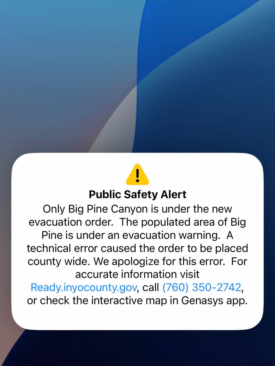
Why Am I Receiving Repeated EVACUATION Alerts?
The Integrated Public Alert and Warning System (IPAWS) is the national emergency alert system used by public safety agencies to send Wireless Emergency Alerts (WEAs) to cell phones. IPAWS alerts automatically expire after 24 hours.
As long as EVACUATION ORDERS or EVACUATION WARNINGS remain in effect, they must be reissued every 24 hours to ensure anyone entering or traveling through affected areas receives current emergency information.
We are aware these periodic alerts are being received by multiple residents, including some outside the immediate affected areas.
Wireless Emergency Alerts are sent based on cell tower coverage areas, which may extend beyond exact evacuation boundaries.
Thank you for your patience and understanding.
For the most up-to-date information, please visit: https://ready.inyocounty.us/pages/rock-cinder
Genasys
https://protect.genasys.com/en/map/37.163122,-118.289512…

—
July 26, 7:48 AM
From Watch Duty:
July 26 Morning Update from CAL FIRE:
There was no growth on the Rock Fire overnight. There was very little smoke visible across the Rock Fire area, though there were hot spots in Armstrong Canyon on the northwest side.
Today, firefighters are focused on building and strengthening containment lines around the fire while continuing mop-up operations.
Weather: Expect southerly winds today through Monday with gusts reaching up to 15 mph, alongside dropping humidity levels. No thunderstorm activity is expected through Monday.
—
July 26, 6:44 AM
From Watch Duty:
The fire is now 45% contained, per CAL FIRE.
—
July 25, 7:57 PM
From Watch Duty:
Current Situation: Crews have initiated suppression repair operations along the southwest perimeter while Interagency Hotshot Crews have been air lifted into the northwest portion of the fire where they will remain over the next two nights, constructing direct control line on the fire’s edge through steep, remote, and inaccessible terrain.
Weather: Hot and dry conditions persisted across the incident area today, accompanied by light winds. Temperatures are forecasted to cool down into the 70s overnight and then heat up into the triple-digits tomorrow with low relative humidity, per the Inyo National Forest on Facebook.
—
July 25, 7:42 PM
From Inyo National Forest:
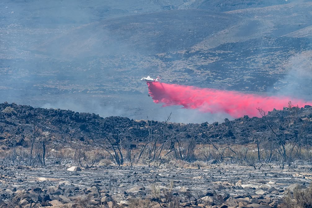
#CinderComplex & #RockFire July 25th evening update
Cinder Complex
Location: Tinnemaha Road and Taboose Creek Road, North of Aberdeen, Inyo County, CA Size: 2,722
Unified Command: CAL FIRE, USFS, BLM and Inyo Sheriff
Percent contained: 15%
Cause: Lightning Start date: July 24, 2026
Rock Fire
Location: Black Rock Springs Road and Hwy 395, Poverty Hills, Inyo County, CA Size: 12,008
Unified Command: CAL FIRE, USFS, BLM and Inyo Sheriff
Percent contained: 40%
Cause: Under Investigation by CAL FIRE Law Enforcement
Start date: July 20, 2026
CURRENT SITUATION:
Firefighters made progress today, successfully establishing containment lines around portions of the Cinder Complex. On the Rock Fire, crews have initiated suppression repair operations along the southwest perimeter while Interagency Hotshot Crews have been air lifted into the northwest portion of the fire where they will remain over the next two nights, constructing direct control line on the fire’s edge through steep, remote, and inaccessible terrain.
WEATHER:
Hot and dry conditions persisted across the incident area today, accompanied by light winds. Temperatures are forecasted to cool down into the 70s overnight and then heat up into the triple-digits tomorrow with low relative humidity.
EVACUATION, SHELTER, AND CLOSURE INFORMATION:
Visit Ready Inyo https://tr.ee/ReadyInyo for the most current and up to date Road Closures, Shelter Locations and Evacuation information.
—
July 25, 5:44 PM
From Watch Duty:
The fire is now 40% contained, per CAL FIRE.
—
July 25, 2:32 PM
From Watch Duty:
The fire has been mapped at 12,008.4 acres by CAL FIRE Intel aircraft. Their perimeter is visible on the Watch Duty map under the Active Fire Perimeters map layer.
Note: Fire perimeters are preliminary and indicate general burn area but do not reflect structure protection efforts by firefighters. A structure within a fire perimeter may not be damaged or destroyed.
—
July 25, 8:22 AM
From Inyo National Forest:
#RockFire Morning Update – July 25, 2026
CURRENT SITUATION:
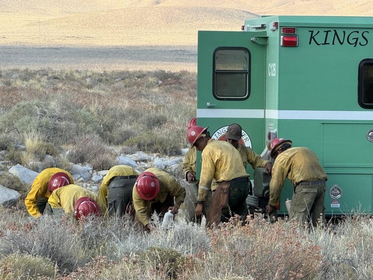
Firefighters made significant progress overnight on the Rock Fire, with the perimeter nearest to Highway 395 showing no visible smoke or active fire activity. In the western portion of the fire, Interagency Hotshot Crews successfully constructed direct handline through challenging granite terrain, while Helitack crews inserted into the northern western portion of the fire cut handline to tie into steep natural granite barriers. Overall, the Rock Fire did not grow overnight, and there was minimal thermal activity detected in Armstrong Canyon. While residual heat remains along the upper crest in the northern and western portions of the fire—leaving potential for fire spread under favorable wind conditions—the overall threat continues to diminish.
WEATHER:
There is a 30–40% chance of afternoon thunderstorms today bringing potential for more erratic outflow winds. A drying trend begins Saturday, with minimum afternoon Relative Humidity dropping into the low teens through the weekend.
EVACUATION, SHELTER, AND CLOSURE INFORMATION: Visit Ready Inyo https://tr.ee/ReadyInyo for the most current and up to date Road Closures, Shelter Locations and Evacuation information
—
July 25, 7:00 AM
From Watch Duty:
The fire is now 35% contained, per CAL FIRE.
—
July 24, 7:57 PM
From Watch Duty:
Earlier in the day, firefighters made steady progress, constructing additional hand line along portions of the fire, including the southern flank. A helitack crew was inserted into the western sector to build containment line, but incoming afternoon thunderstorms forced an evacuation of the area for crew safety. On the northeastern flank, the main fire held within existing containment lines.
Several new fires started on the north end of the incident in the Red Mountain area. The largest of these starts grew to an estimated 200 acres; however, all activity remains west of Highway 395. Firefighters will work through the night to construct containment lines around these new starts. All fire activity remains within established geographic incident objectives.
High temperatures in the low 100s will produce severe heat conditions, further hindering fire suppression efforts. Additional thunderstorms forecast for Saturday afternoon may pose further safety hazards to personnel and impede line construction. – per CAL FIRE BDU on Facebook
Additional updates regarding these new fires can be found on the 5-3 Fire and 5-4 Fire incidents on Watch Duty.
—
July 24, 6:37 PM
From Inyo County Sheriff’s Office:
Due to increased fire activity on the Rock Fire, southbound U.S. Highway 395 will be closed north of Fish Springs.
Personnel are responding
Please avoid the area and do not attempt to bypass road closures. Updates will be provided as conditions change.
—
July 24, 5:47 PM
From Watch Duty:
The fire is now 30% contained, per CAL FIRE.
—
July 24, 7:52 AM
From Inyo National Forest:
Morning Update, July 24
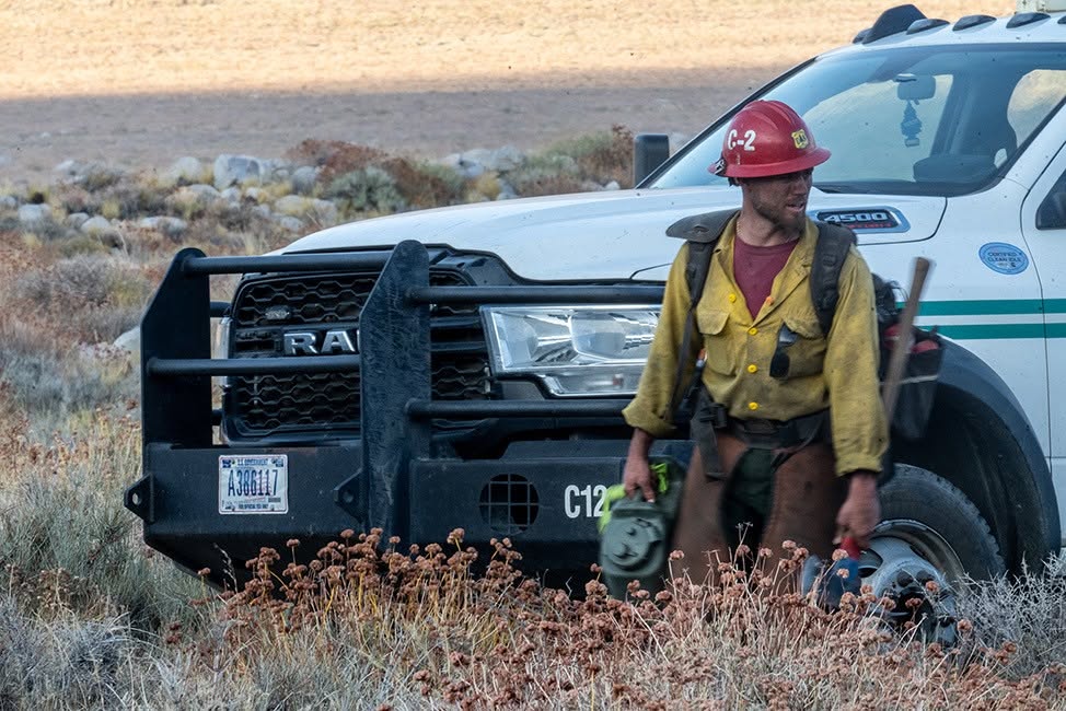
CURRENT SITUATION: Overnight, fire activity on the Rock Fire moderated due to stagnant winds, allowing ground crews to make good progress constructing and strengthening containment lines. Along Highway 395, firefighters continued mop-up operations and identified hot-spots. Most of the fire behavior remained isolated to Armstrong Canyon in the northern portion of the fire, where localized torching was observed, alongside a few lingering hot spots just to the north.
Today incident command will focus on inserting Hotshot and Type 1 hand crews into the steep, inaccessible terrain across the northern and northwestern flanks of the fire. Air assets will provide direct support as flight conditions allow to maximize both firefighter safety and operational efficiency.
WEATHER:
Today’s weather will present challenging fire suppression conditions. Firefighters will experience hot temperatures exceeding 100°F, low afternoon relative humidity, and mostly sunny skies. While widespread strong winds are not anticipated, terrain-driven upslope and downslope winds, along with localized gusts from any nearby thunderstorm development, could produce sudden changes in fire behavior.
EVACUATION, SHELTER, AND CLOSURE INFORMATION: Visit Ready Inyo https://tr.ee/ReadyInyo for the most current and up to date Road Closures, Shelter Locations and Evacuation information.
—
July 24, 6:02 AM
From Watch Duty:
The fire is now 25% contained, per CAL FIRE.
—
July 23, 9:58 PM
From Inyo National Forest:
July 23 Evening Update
Percent contained: 20% | Size: 11,974
Unified Command: CAL FIRE, USFS, CHP and Inyo Sheriff
Cause: Under Investigation
CURRENT SITUATION:
The Rock Fire was very active today in Division Mike in the Northwest portion but stayed within the control objectives. In the afternoon, the winds changed and aligned with the terrain and made isolated runs. It continues to threaten Shingle Mill Bench and still has the potential to threaten the northern containment lines.
Firefighters made more progress building containment lines from Highway 395 up Division Creek Road. Firefighters continue to mop up and patrol in the community of Aberdeen.
Suppression repair has begun. Fire repair specialists are inspecting the fire area to evaluate damage caused by fire suppression. In the coming days, additional personnel and specialized equipment will be ordered to complete these repairs. This area has a rich fire history, complicated by challenging terrain, unique weather patterns, and culturally sensitive areas.
CAL FIRE Damage Inspection Teams are in the area as part of standard wildfire response protocols, assessing affected areas and determining whether any structures have been impacted by the fire.
WEATHER:
Winds will be light overnight with a chance for gusty outflow winds on Friday with highs in the mid-80s across the fire area. Active fire behavior is expected in the afternoon and evening due to hot and dry conditions.
EVACUATION, SHELTER, AND CLOSURE INFORMATION:
Visit Ready Inyo https://tr.ee/ReadyInyo for the most current and up to date Road Closures, Shelter Locations and Evacuation information.
—
July 23, 6:11 PM
From Watch Duty:
The Evacuation Warnings have been lifted for Zones: ICU-131-B & ICU-143-B – per the Genasys Evacuation Map.
The fire is now 20% contained – per CAL FIRE.
Additionally the fire has been mapped at 11,973.6 acres by CAL FIRE Intel aircraft. Their perimeter is visible on the Watch Duty map under the Active Fire Perimeters map layer.
Note: Fire perimeters are preliminary and indicate general burn area but do not reflect structure protection efforts by firefighters. A structure within a fire perimeter may not be damaged or destroyed.
—
July 23, 3:17 PM
From LADWP:
As of July 23, 2026, power has been restored for all LADWP customers impacted by the Rock Fire. While electric service is back on, our crews remain hard at work repairing and replacing power poles to ensure full restoration for the community.
In response, our crews have been actively providing essential resources to aid firefighting operations. Five LADWP power crews, including three Los Angeles based pole crews are focused on replacing damaged utility poles. Our local water crews have been working closely with CalFire supplying water dozers, tenders, and a draft pump to support fire efforts.
Affected residents seeking LADWP outage updates, service assistance, or safety information can call 760-873-0251 or visit our webpage at LADWP.com/EasternSierra.
Our teams are with you every step of the way ensuring the community is informed as we make steady progress.
—
July 23, 3:09 PM
From Watch Duty:
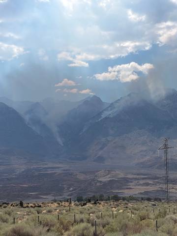
User submitted photo.
—
July 23, 11:12 AM
From Watch Duty:
The fire is 11,645 acres, per CAL FIRE.
—
July 23, 9:57 AM
From Watch Duty:
The fire is 11,635 acres and 18% contained, per Ready Inyo.
—
July 23, 9:25 AM
From Inyo National Forest:
Morning Update – July 23
CURRENT SITUATION: Firefighters continue to make progress building and reinforcing containment lines in steep and challenging terrain. Crews will continue operations focusing their main efforts of work in the Northwest flank of the fire. Around the fire perimeter, crews are mopping-up up to 200 feet in. There was some active fire overnight in isolated areas but flames stayed well within control lines. Night flying helicopters continued working across the fire and air tankers will continue making retardant drops where necessary during day operations.
CAL FIRE Damage Inspection Teams are in the area as part of standard wildfire response protocols, assessing affected areas and determining whether any structures have been impacted by the fire.
WEATHER:
Today’s weather will present challenging fire suppression conditions. Firefighters will experience hot temperatures exceeding 100°F, low afternoon relative humidity, and mostly sunny skies. While widespread strong winds are not anticipated, terrain-driven upslope and downslope winds, along with localized gusts from any nearby thunderstorm development, could produce sudden changes in fire behavior.
EVACUATION, SHELTER, AND CLOSURE INFORMATION: Visit Ready Inyo https://tr.ee/ReadyInyo for the most current and up to date Road Closures, Shelter Locations and Evacuation information.
Fire information email: [email protected]
—
July 22, 11:01 PM
From Watch Duty:
The fire is 11,631.7 acres per the perimeter uploaded to the National Interagency Fire Center (NIFC), which is visible on the Watch Duty map under the Active Fire Perimeters map layer.
Note: Fire perimeters are preliminary and indicate general burn area but do not reflect structure protection efforts by firefighters. A structure within a fire perimeter may not be damaged or destroyed.
—
July 22, 7:00 PM
From CAL FIRE:
The fire is currently 11,141 acres and is 15% contained.
Current Situation: Fire crews made significant progress today on constructing and reinforcing containment lines across the Rock Fire incident. Fire activity along the southeast flank has been successfully secured, allowing personnel to transition into perimeter reinforcement and initiate suppression repair in areas where the fire’s edge abuts Highway 395, which continues to hold.
The western flank remains active as the fire has transitioned onto U.S. Forest Service and Bureau of Land Management jurisdictions. CAL FIRE remains fully committed to supporting our federal partners on these lands, maintaining an aggressive suppression strategy while prioritizing unified operations and addressing the needs of local communities. Our primary operational focus remains on the northwest sector of the fire. Ground crews and heavy equipment are working aggressively to fortify control lines in this critical area to eliminate the threat and prevent further impacts to northern communities.
Firefighters will continue working through the night to strengthen containment lines and protect nearby communities. Ground crews, supported by night flying helicopters, will continue suppression efforts as conditions allow.
Weather: Overnight weather conditions are expected to remain warm with generally light winds, allowing firefighters to continue suppression efforts through the night. Looking ahead to tomorrow, temperatures are expected to climb into the upper 90s with the potential for afternoon winds and isolated thunderstorms. These conditions could increase fire activity and present additional challenges for firefighters working to contain the fire.
EVACUATION, SHELTER, AND CLOSURE INFORMATION: Visit Ready Inyo https://tr.ee/ReadyInyo for the most current and up to date Road Closures, Shelter Locations and Evacuation information.
Fire information email: [email protected]
—
July 22, 7:15 PM
From Watch Duty:
The fire is now 11,141 acres due to more accurate mapping, per CAL FIRE.
—
July 22, 5:50 PM
From Watch Duty:
The fire is now 15% contained, per CAL FIRE.
—
July 22, 5:45 PM
From Chalfant Valley Fire Department:
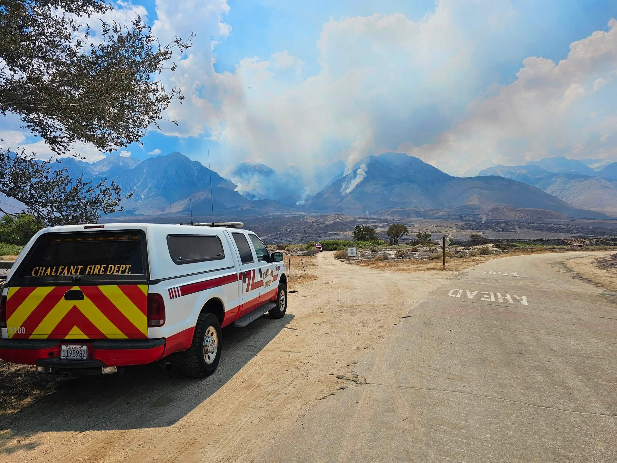
Chalfant Valley Fire Department Water Tender 5181 is currently assigned to the Rock Fire in Inyo County, supporting firefighting operations alongside crews from across the region.
The Rock Fire is currently estimated at 11,479 acres with 15% containment. The cause of the fire remains under investigation.
We are proud of our volunteers who continue to answer the call, providing critical resources to help protect lives, property, and our communities. Please keep all firefighters and first responders in your thoughts as they continue their work on the fire line.
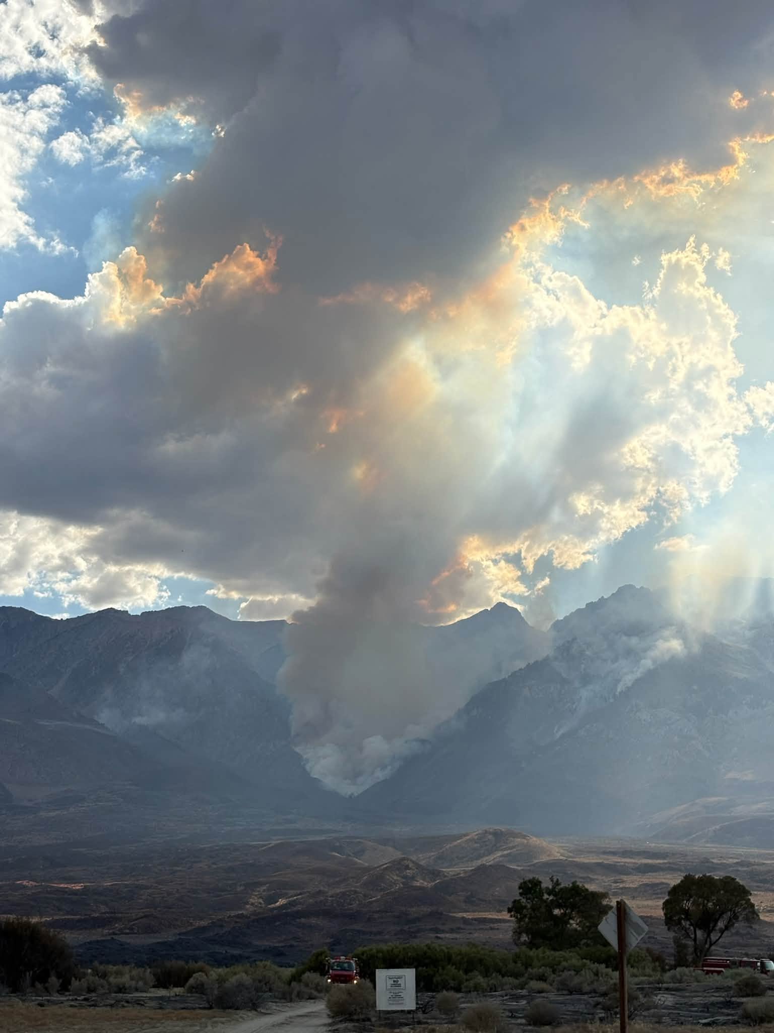
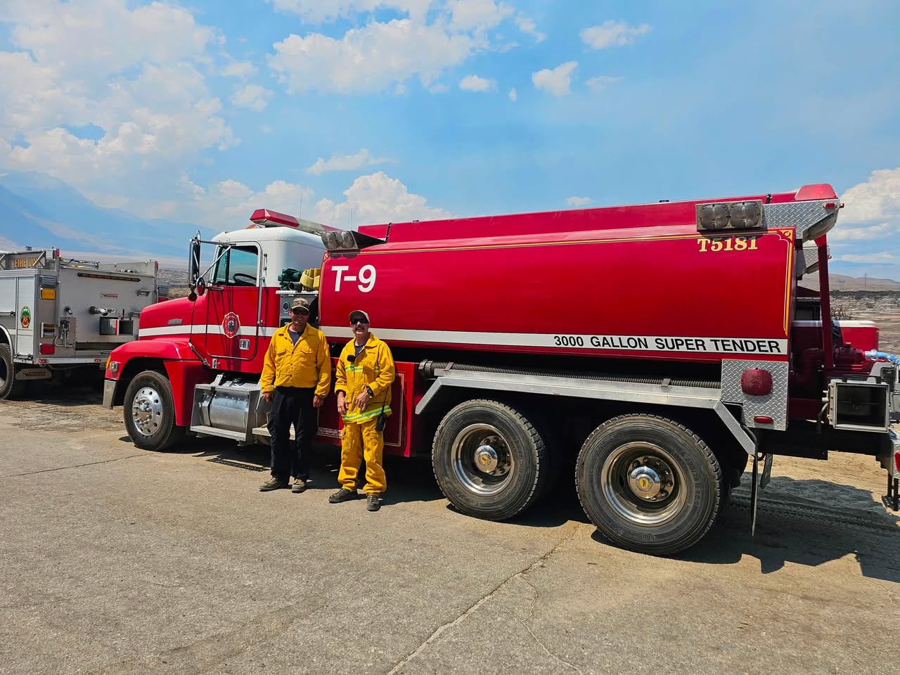
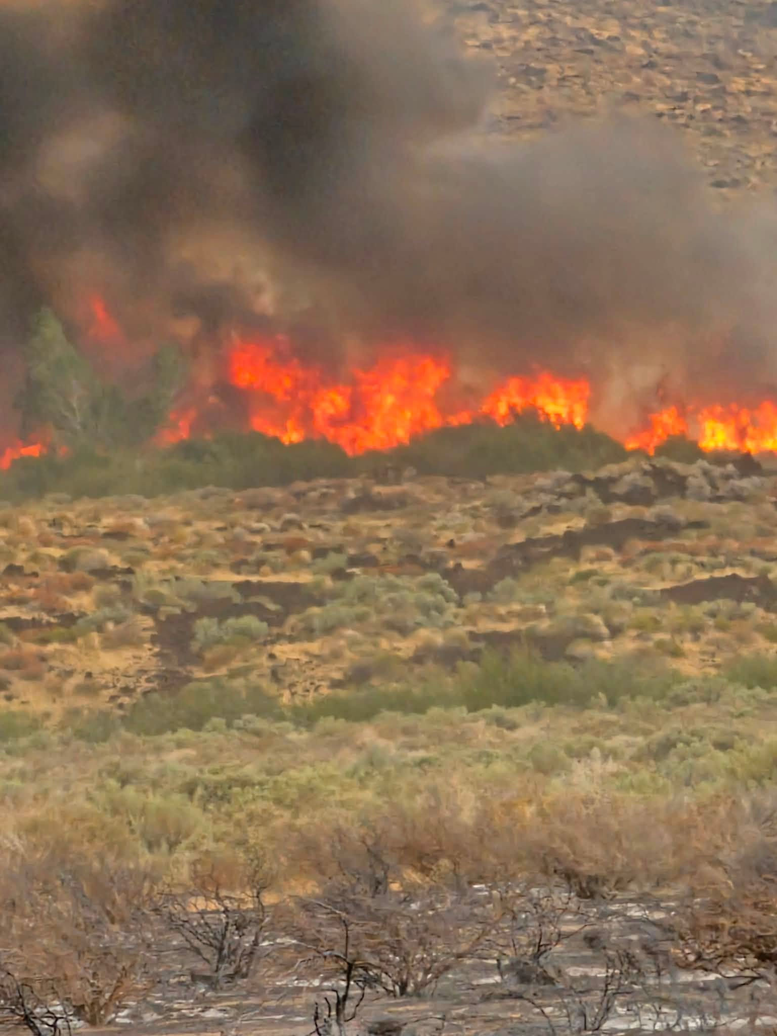
—
July 22, 5:37 PM
From Watch Duty:
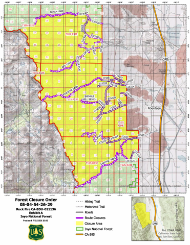
A Forest Closure has been issued for the area, per Inciweb.
For the full description of the Forest Closure, please visit the Inciweb link. An image of the closure map is attached above as well.
—
July 22, 4:10 PM
From Watch Duty:
The fire has been mapped by the National Interagency Fire Center (NIFC). Their perimeter is visible on the Watch Duty map under the Active Fire Perimeters map layer.
Note: Fire perimeters are preliminary and indicate general burn area but do not reflect structure protection efforts by firefighters. A structure within a fire perimeter may not be damaged or destroyed.
—
July 22, 2:00 PM
From CAL FIRE:
CURRENT SITUATION:
This afternoon, the Rock Fire remains holding within existing containment lines.
Due to steep, rugged terrain and limited vehicle access, additional operational resources are being committed to the incident. Interagency Hotshot Crews are being inserted into remote sections of the fireline. Crews will be “spiking out”—establishing primitive camps directly on the line for multiple days—to construct critical handline in hard-to-reach areas.
During afternoon operations, aviation assets will continue active aerial support in Divisions Mike and Whiskey on the fire’s northern flank.
WEATHER:
A warming and drying trend will bring triple-digit temperatures over the next several days. Dropping relative humidity levels and rising temperatures will continue to dry out surrounding vegetation, increasing fuel receptivity. Despite these challenging weather conditions, fire behavior remains moderate with improved visibility as smoke clears, allowing ground crews to make steady progress.
EVACUATION, SHELTER, AND CLOSURE INFORMATION:
Visit Ready Inyo https://tr.ee/ReadyInyo for the most current and up to date Road Closures, Shelter Locations and Evacuation information.

July 22, 11:41 AM
From Watch Duty:
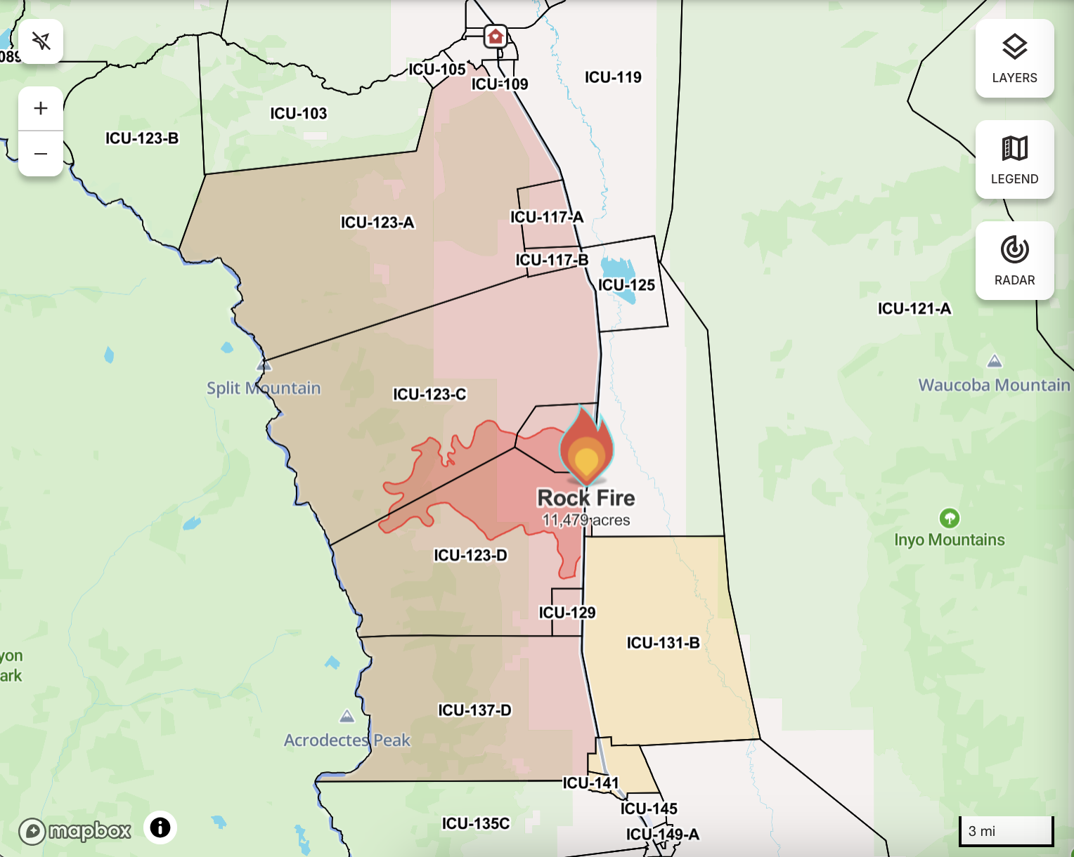
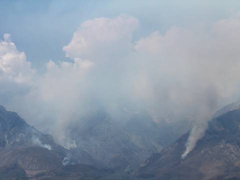
The fire is now 11,479 acres, per CAL FIRE.
An additional four Air Tankers, including one Very Large Air Tanker (VLAT), have been ordered per Air Attack, for a total of nine fixed-wing Air Tankers assigned to work the fire. Additionally there are multiple helicopters assigned, as viewed on the Watch Duty Flight Tracker layer.
—
July 22, 11:16 AM
From Watch Duty:
The fire is 10,650.2 acres per the perimeter uploaded to the National Interagency Fire Center (NIFC), which is visible on the Watch Duty map under the Active Fire Perimeters map layer.
Note: Fire perimeters are preliminary and indicate general burn area but do not reflect structure protection efforts by firefighters. A structure within a fire perimeter may not be damaged or destroyed.
—
July 22, 9:01 AM
From Ready Inyo:
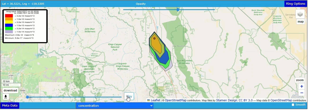
Below is the smoke plume forecast for today, 7/22/2026 on the #RockFire from US National Weather Service Las Vegas Nevada. This time-lapse gif covers from 2am until 4pm today.
If you are sensitive to smoke, here is more info on the air quality data from the Rock Fire, and other helpful links about precautions you can take to protect your health: https://www.gbuapcd.org/AirMonitoringData/Smoke/…
—
July 22, 8:17 AM
From Caltrans:
UPDATE: U.S. 395 remains OPEN while CAL FIRE unit CAL FIRE San Bernardino/Inyo/Mono actively fights the #RockFire. There is a southbound lane closure between Aberdeen Station Road and Black Rock Springs Road.
Due to a power outage the Division Creek Rest Area on U.S. 395 is CLOSED.
Please visit Ready Inyo at https://ready.inyocounty.us/pages/rock-fire for more information on the status of the #RockFire
Visit QuickMap at https://quickmap.dot.ca.gov/ for road closures and conditions before you travel on the highway.
—
July 22, 7:00 AM
From CAL FIRE:
Current Situation: Firefighters remain focused on perimeter containment and structure protection. The fire progressed; however, it stayed within existing control lines. Active fire behavior is expected in the afternoon and evening as temperatures rise and relative humidity drops. The fire continues to burn through heavy brush and grass, pushing onto steeper slopes into timber, but hasn’t progressed further.
Weather: The monsoonal moisture pattern has weakened and the weather is moving towards higher temperatures for the duration of the week. Evacuation orders and warnings remain in effect, and residents are urged to adhere to them. If winds strengthen, fire activity could increase, potentially necessitating additional evacuations.
Communities and infrastructure near Birch Creek, Fish Springs, Tinnemaha Campground, Baxter Ranch, and the Perlite Mine remain threatened.

—
July 22, 5:55 AM
From Watch Duty:
The fire is now 8,000 acres, per CAL FIRE.
—
July 21, 9:33 PM
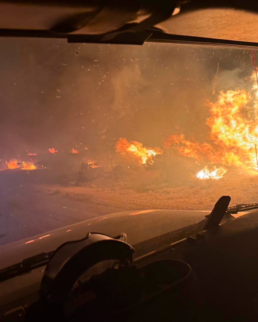
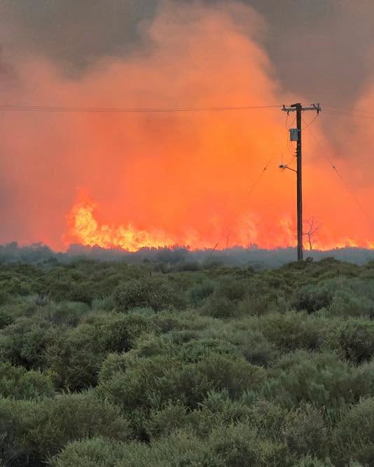
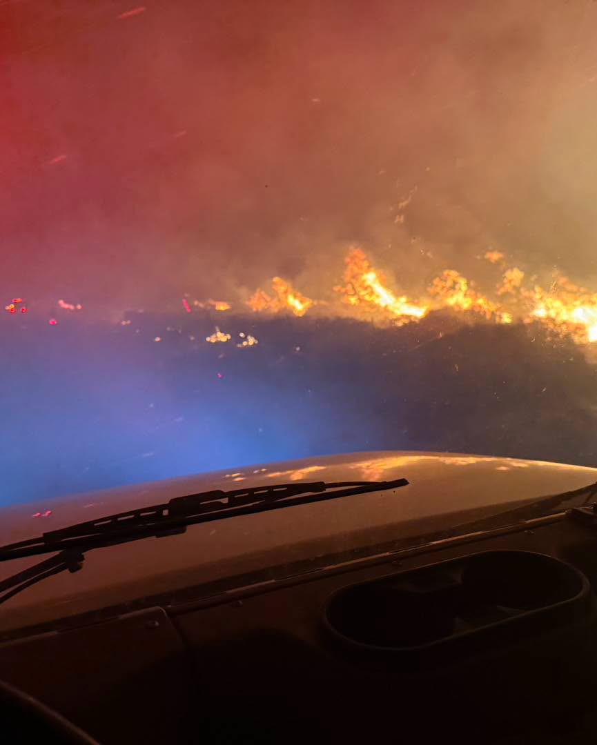
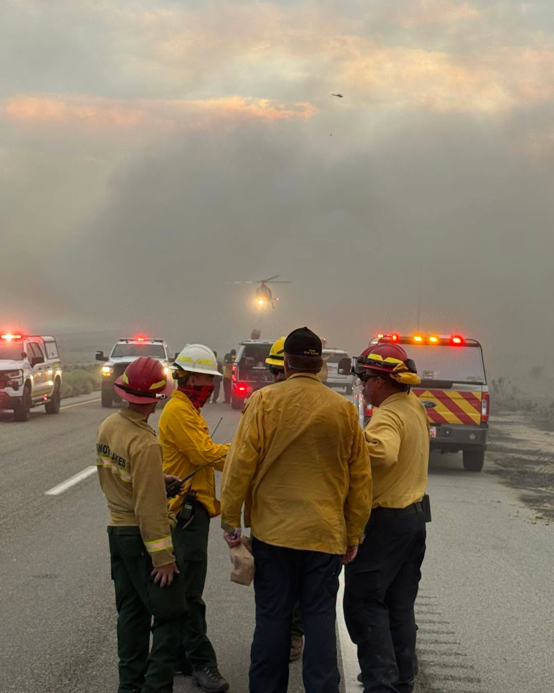
From White Mountain Fire Department:
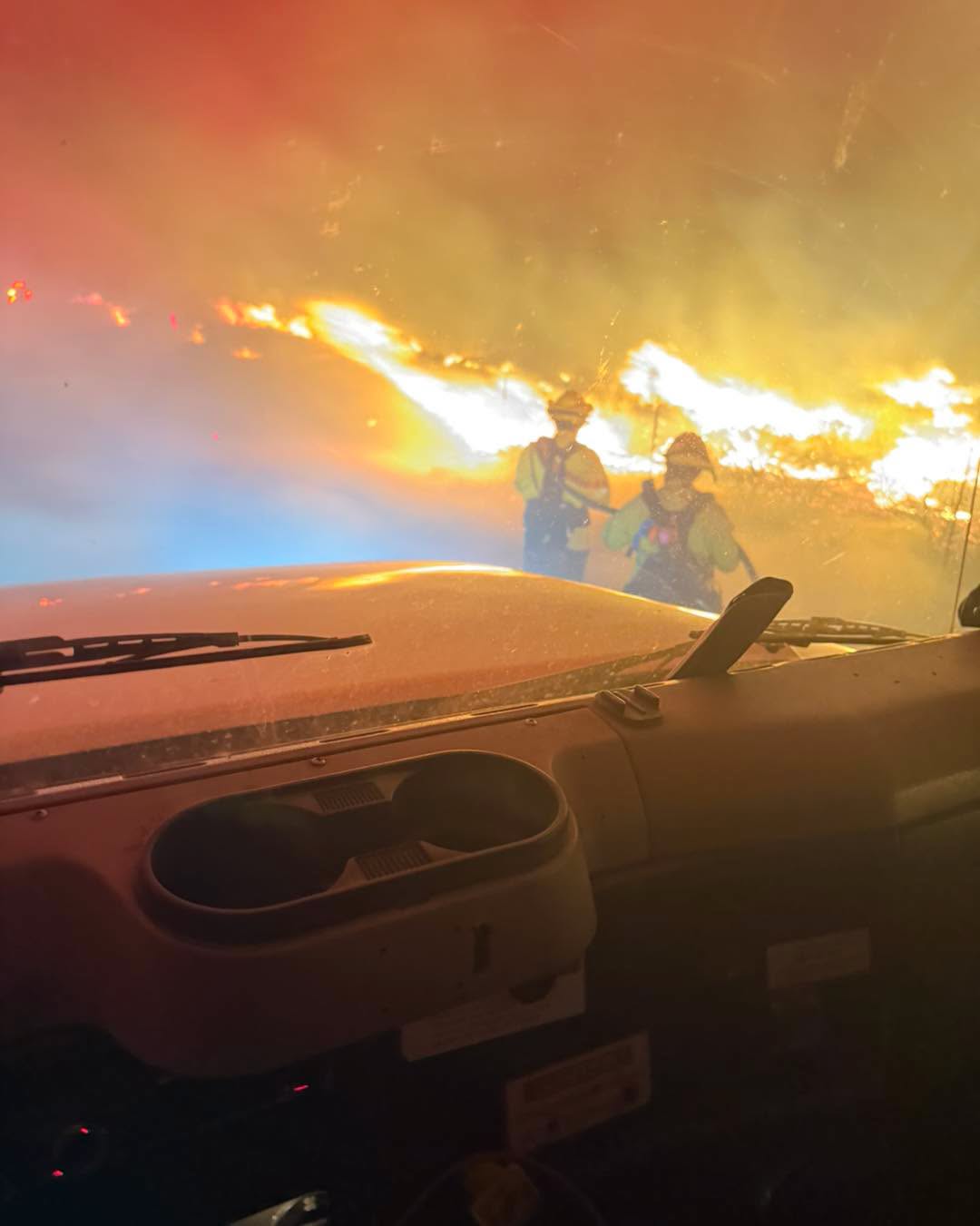
Photos from the #Rockfire last night. White Mountain Engine 3033 is part of Mono County Type 3 Engine Strike Team helping battle this fire.
—
July 21, 7:00 PM
From CAL FIRE:
CURRENT SITUATION:
Today strong northern winds continued to push Rock Fire flames toward Birch Creek, Fish Springs, Tinemaha Campground, Baxter Ranch, and the Perlite Mine area. The fire has moved into several campgrounds and is directly abutting campsites and impacting power lines; however, no injuries, structure losses, or property losses have been reported. Joint air and ground resources are actively coordinating suppression and structure protection efforts wherever safety allows.
Firefighters face environmental and terrain obstacles. The fuels consist primarily of rabbit brush, sage brush, and salt grass interspersed with sharp lava rock, which prevents bulldozers from accessing major portions of the fire perimeter. Firefighters are also dealing with complex local wind patterns: the diurnal shift typically pushes the fire southwest and upslope to the north in the morning, followed by a dramatic 180-degree pivot back to the south between 2:00pm and 4:00pm.
The overnight strategy leverages lighter wind conditions to secure the heel of the fire, ensuring it
does not outflank crews when the wind direction turns again.
WEATHER:
Today’s operations were also complicated by severe weather downdrafts, thunderstorms, and lightning, which periodically forced crews to temporarily disengage for safety. Temperatures are forecasted to climb into the 100s by the end of the week, though predictable diurnal wind patterns are expected to return tomorrow.
EVACUATION, SHELTER, AND CLOSURE INFORMATION:
Visit Ready Inyo https://tr.ee/ReadyInyo for the most current and up to date Road Closures, Shelter Locations and Evacuation information

—
July 21, 3:19 PM
From Watch Duty:
Additional Evacuation Centers have been established for the Rock Fire at the following locations, per Ready Inyo:
- Big Pine Town Hall, 150 Dewey Street, Big Pine (180 is on the actual building)
- Inyo County Consolidated Office Building, 1360 N. Main St., Room 100, Bishop
Available shelters may be viewed on the Watch Duty map or under the Shelters Tab for this incident.
—
July 21, 2:41 PM
From CAL FIRE:
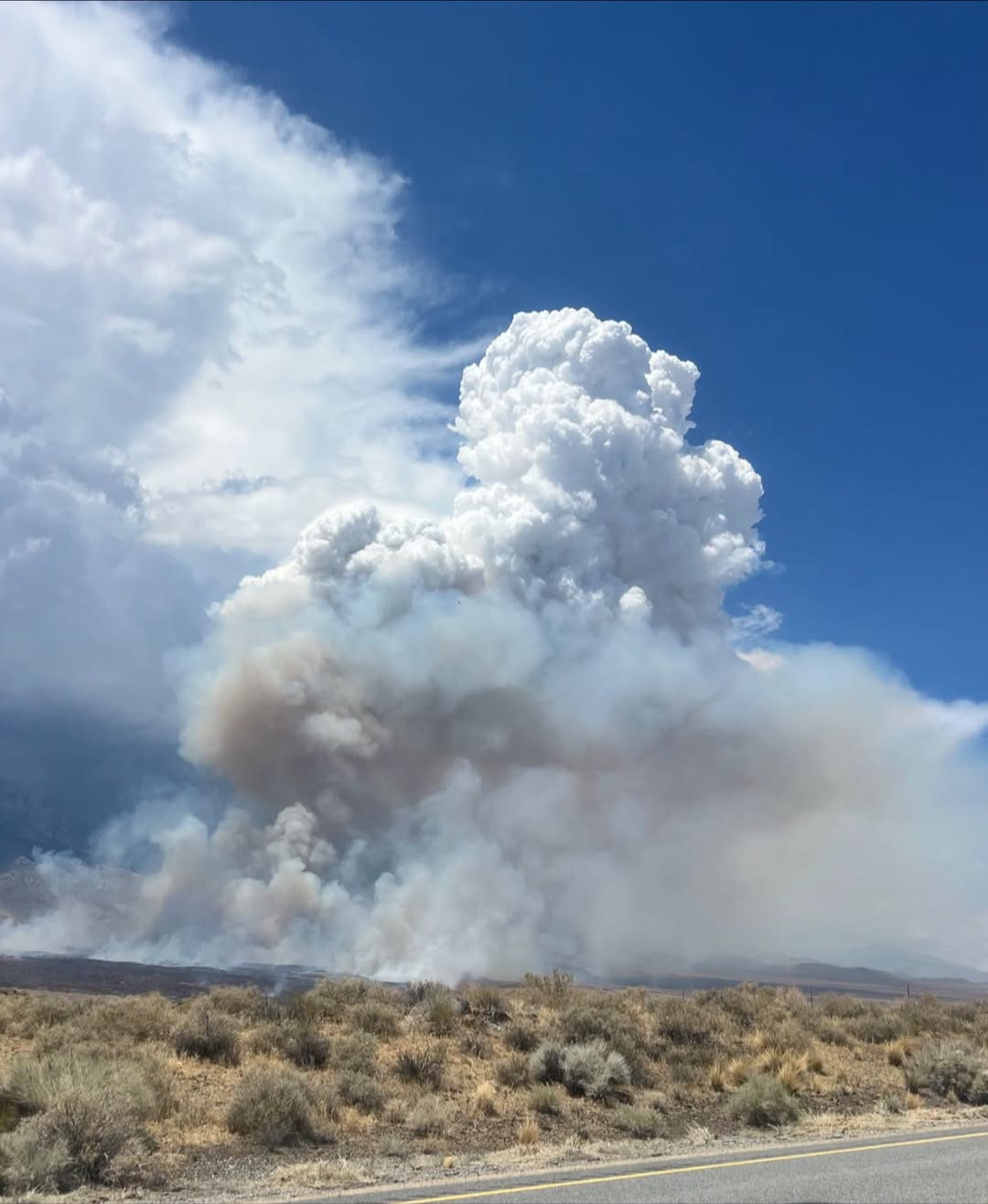
ROCK FIRE – Situational Update 7.21.26 2:00 pm
The Rock Fire remains active today as strong winds continue pushing the fire toward the Birch Creek, Fish Springs, Tinemaha Campground, Baxter Ranch, and Perlite Mine areas. Firefighters are working to protect threatened communities and critical infrastructure while utilizing both ground and aerial resources as conditions allow.
Thunderstorms and lightning continue to impact the incident, creating hazardous conditions for firefighters. For the safety of personnel, crews may temporarily disengage from direct firefighting operations when lightning is present. Firefighters will resume suppression efforts as soon as conditions are safe.
Residents and visitors in the area should remain vigilant, be prepared for changing fire conditions, and continue to monitor updates. If you are in or near impacted areas, be ready to act should evacuation warnings or orders be issued.
—
July 21, 1:44 PM
From LADWP:
LADWP power crews are actively responding to provide temporary power and begin power pole replacements after the Rock Fire impacted approximately 100 LADWP poles in the area yesterday. Currently, our power system is working to have all power restored by the time evacuation orders are lifted.
LADWP is providing CalFire with critical resources, including water tenders and dozers, and a water pump to help draw from local water sources. In addition, LADWP employees who are active volunteer firefighters with local fire departments are responding on the ground to assist with containment and safety measures. Our dedicated employees are working safely alongside emergency personnel to protect the community and ensure essential utility services remain available during the Rock Fire incident.
We understand the stress this situation places on the community, and we are committed to keeping our customers supported and informed throughout this incident. Affected residents seeking outage updates, service assistance, or safety information can call 760-873-0251 or visit www.LADWP.com/EasternSierra.
—
July 21, 1:13 PM
From Ready Inyo:
Evacuation Warnings for Zones 117-A and 123-A were upgraded to Orders.
From Watch Duty:
These zone changes are viewable on the Watch Duty map as well as the Genasys Protect Map.
—
July 21, 11:34 AM
From Watch Duty:

—
July 21, 11:20 AM
From CAL FIRE:
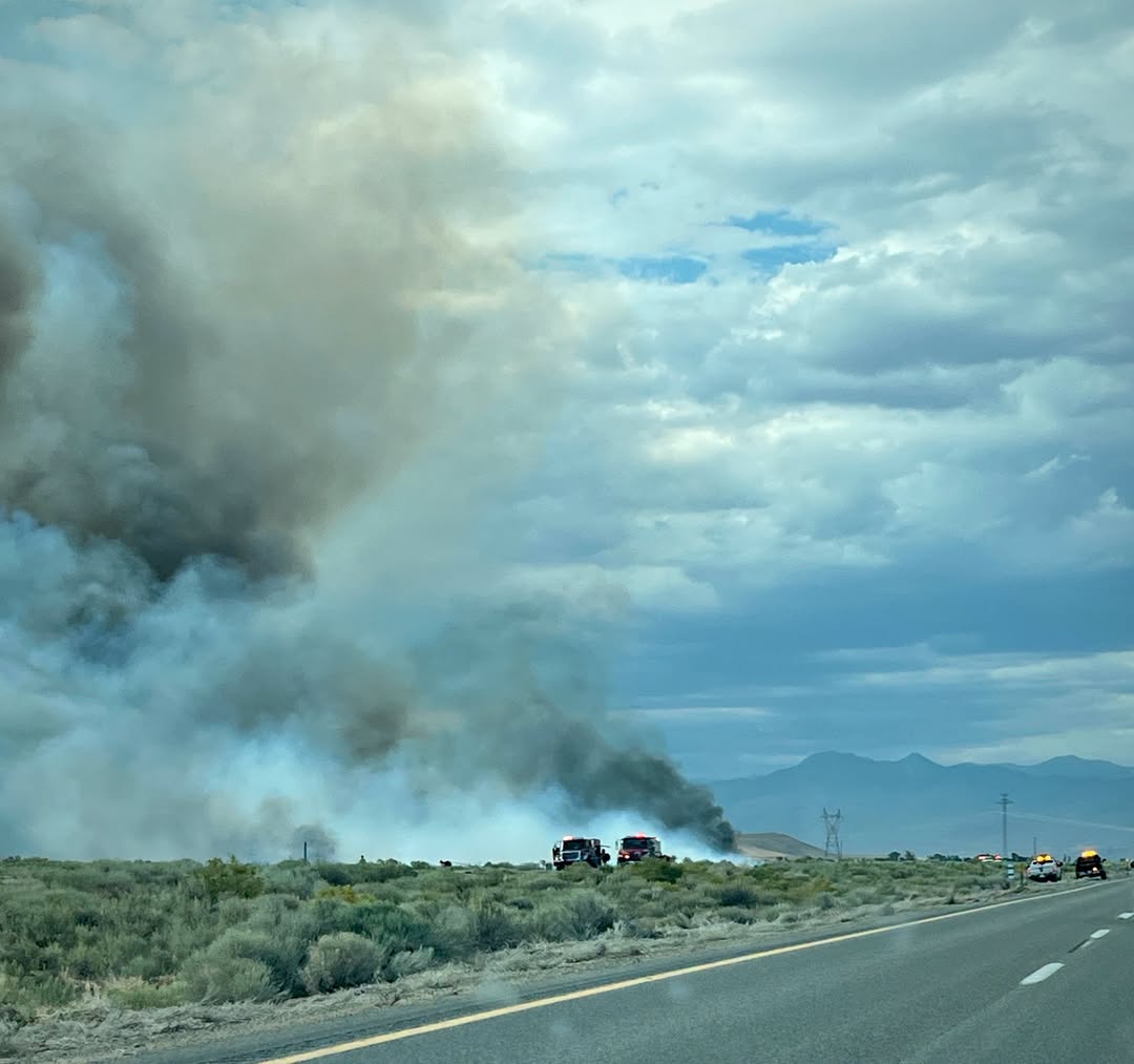
The Rock Fire is currently 5,500 acres and 5% contained. The fire remained active overnight along the northern portion of its perimeter. Erratic winds and dead, dry vegetation continue to challenge firefighting efforts.
Firefighters on the ground are working alongside aerial resources while navigating difficult weather conditions. Fixed-wing aircraft will continue dropping fire retardant around the perimeter, while helicopters will conduct frequent water drops as wind conditions safely allow.
Residents and visitors should visit https://tr.ee/ReadyInyo for the most current:
- Evacuation orders and warnings
- Emergency shelter information
- Animal evacuation locations
- Road closures
The public is encouraged to continue monitoring https://tr.ee/IncidentPortal as conditions may change
rapidly.
—
July 21, 10:18 AM
From Watch Duty:
The fire’s size is currently reported at 5,500 acres, per CAL FIRE.
—
July 21, 10:00 AM
From Inyo County:
With U.S. 395 now open again, county facilities will reopen to the public in Independence. Most offices will return to normal operations, however it’s strongly recommended members of the public call ahead before visiting.
—
July 21, 8:42 AM
From Caltrans:
The right southbound lane on U.S. 395 from Aberdeen to Black Rock Springs Road is OPEN. Currently, the left southbound lane on U.S. 395 is still CLOSED from Aberdeen to Black Rock Springs Road due to the Rock Fire. This is an ACTIVE INCIDENT. Please stay alert for CAL FIRE San Bernardino/Inyo/Mono Unit personnel if driving through the area. For more road conditions and closures, visit https://quickmap.dot.ca.gov/.
July 21, 8:30 AM
From Ready Inyo:
County Road closures enacted for Tinnemaha, Black Rock, Goodale, and Aberdeen Station Roads.
—
July 21, 7:21 AM
From Caltrans:
The northbound lanes on U.S. 395 from Lone Pine to Fish Springs Road are OPEN. Currently, the southbound lanes on U.S. 395 are still CLOSED due to the Rock Fire. This is an ACTIVE INCIDENT.
Visit QuickMap for more road conditions and closures: https://quickmap.dot.ca.gov/
—
July 21, 7:16 AM
From Inyo County:
All county facilities in Independence are closed to the public during the indefinite closure of U.S. 395 from Lone Pine to just south of Big Pine due to the Rock Fire.
The public will be notified when operations return to normal.
—
July 21, 6:32 PM
From Watch Duty:
The fire is now 5% contained, per CAL FIRE.
—
July 20, 10:52 PM
https://www.facebook.com/easternsierranow/videos/2818317475201501
—
July 20, 10:31 PM
From Watch Duty:
10:30pm update from CAL FIRE: The fire is currently estimated at 2,500 acres and remains 0% contained.
The fire is burning in heavy brush along Highway 395 and poses a direct threat to motorists traveling on the busy highway. Strong and erratic wind gusts continue to create challenging conditions for firefighters.
CAL FIRE San Bernardino–Inyo–Mono Unit is in unified command with the Inyo County Sheriff’s Office, California Highway Patrol and the U.S. Forest Service, Inyo National Forest. Evacuation orders and warnings remain in effect.
Road closures are in place throughout the affected area for public and firefighter safety. Motorists are asked to avoid the area, obey all closures and use alternate routes when possible. Residents and visitors should visit https://tr.ee/ReadyInyo for the most current:
- Evacuation orders and warnings
- Emergency shelter information
- Animal evacuation locations
- Road closures
The public is encouraged to continue monitoring https://tr.ee/IncidentPortal as conditions may change rapidly.
—
July 20, 10:30 PM
From CAL FIRE:

—
July 20, 10:22 PM
https://www.facebook.com/easternsierranow/videos/875367021924059
—
July 20, 10:12 PM
From Watch Duty:
The fire is now 2,500 acres, per CAL FIRE.
—
July 20, 10:05 PM
https://www.facebook.com/easternsierranow/videos/1485024566975741
—
July 20, 9:00 PM
From Ready Inyo:
Big Pine Town Hall Evacuation Center closed due to lack of need.
—
July 20, 8:38 PM
From CAL FIRE:
The Rock Fire is now 1,795 acres. Fire perimeter mapped by sensor aircraft.
—
July 20, 8:19 PM
From WatchDuty:
Due to the Highway 395 shut down in both directions, additional evacuation centers were activated at Statham Hall, and at the Lone Pine High School Farm for large animals/livestock, per Ready Inyo.
2 night-flying copters are now responding, per radio traffic.
—
July 20, 7:55 PM
From Caltrans:
7:55 pm: The full closure of U.S. 395 has been EXTENDED. The highway is now CLOSED from Lone Pine Narrow Gauge Road in Lone Pine to Aberdeen Station Road. There is no estimated time of reopening.
—
July 20, 7:23 PM
From Watch Duty:
Evacuation Orders have been issued for Zones ICU-123-D, ICU-131-C, ICU-129, & ICU-137-D.
Evacuation Warnings have been issued for Zones ICU-131-B, ICU-141, & ICU-143.
Per the Genasys Evacuation Map.
These Zones are visible on the Watch Duty map or by visiting Genasys Protect.
—
July 20, 7:20 PM
From Ready Inyo:
Additional Evacuation Warnings were issued for Zones 131-B, 143, and 141, located on the Fort Independence Indian Reservation area, both sides of Highway 395.
From CAL FIRE:
Evacuations have been updated for the Rock Fire. Acreage size has increased to 1,443 acres due to high wind gusts in the area. Threat to structures and critical infrastructure. Significant augmentation of air and ground resources.
—
July 20, 7:18 PM
From Ready Inyo:
Additional Evacuation Orders were issued for Zones 123-D, 129, 131-C, and 137-D, north of Fort Independence Indian Reservation area, mostly on west side of Highway 395.
—
July 20, 7:08 PM
From Watch Duty:
The fire has been mapped at 1442.5 acres by FIRIS OES Intel 24. Their perimeter is visible on the Watch Duty map under the Active Fire Perimeters map layer.
Note: Fire perimeters are preliminary and indicate general burn area but do not reflect structure protection efforts by firefighters. A structure within a fire perimeter may not be damaged or destroyed.
—
July 20, 6:49 PM
From Watch Duty:
The fire is now 1200 acres, per CAL FIRE.
Highway 395 FULL CLOSURE between Aberdeen Station Road to 1.5 miles south near the Division Creek Rest Stop, per Ready Inyo.
—
July 20, 6:35 PM
From Caltrans:
U.S. 395 is FULLY CLOSED in both direction from the Division Creek Safety Roadside Rest Area to Aberdeen Station Road due to wildfire. There is no estimated time of reopening.
—
July 20, 6:34 PM
From Watch Duty:
The fire is now 400 acres, potential for 3000 acres. Incident Command requesting an additional 10 strike teams of engines (50 engines) immediate need, per CAL FIRE BDU on X.
—
July 20, 6:16 PM
From Watch Duty:
Zone ICU-177 has been split into two zones, ICU-117-B & ICU-117-A.
Zones ICU-177-B & ICU-123-C have been upgraded to Evacuation Orders, per the Genasys Evacuation Map.
The fire is currently 200 acres with a moderate rate of spread. An additional two tankers have been requested for a total of six, per CAL FIRE BDU on X.
—
July 20, 6:12 PM
From CAL FIRE:
Evacuations are in place for the Rock Fire. Acreage has increased to 200 acres.
—
July 20, 6:12 PM
https://www.facebook.com/reel/1924155368268999
—
July 20, 6:10 PM
From Ready Inyo:
Evacuation Warnings for Zones 117-B, 123-C were changed to mandatory Orders.
—
July 20, 5:53 PM
From Watch Duty:
Livestock may be taken to the Tri-County Fairgrounds using the stalls and pens near the Tallman Building: 475 Sierra Street, Bishop, CA 93515, per Ready Inyo.
—
July 20, 5:52 PM
From Caltrans:
Both southbound lanes of U.S. 395 are CLOSED between Aberdeen Station Road to 1.5 miles south near the Division Creek Safety Roadside Rest Area due to a wildfire. There is no estimated time of reopening. For current updates on road conditions, visit Caltrans Quickmap.
—
July 20, 5:36 PM



July 20, 5:31 PM
From Watch Duty:

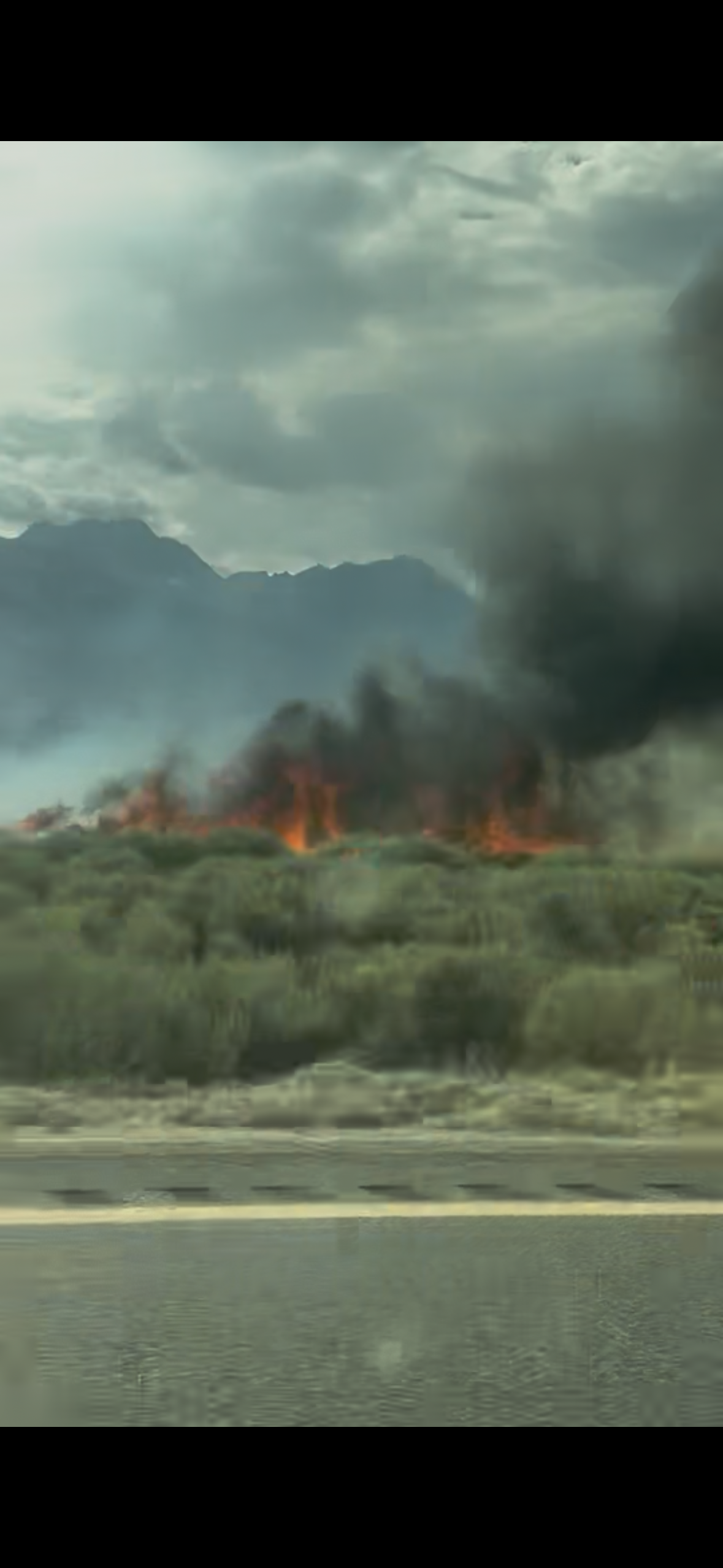
4 additional airtankers have been requested, per CAL FIRE BDU on X.
Smoke from the fire is visible on the camera attached above.
—
July 20, 5:29 PM
From Ready Inyo:
Evacuation Warnings were issued for Zones 117, 123-A, and 123-C by the Inyo County Sheriff’s Department.
—
July 20, 5:23 PM
From Watch Duty:
Evacuation Warnings have been issued for Zones ICU-123-C, ICU-123-A, & ICU-117, per the Genasys Evacuation Map.
There is a closure of Highway 395 South, per CAL FIRE.
These Zones are visible on the Watch Duty map or by visiting Genasys Protect.
—
July 20, 5:13 PM
From Watch Duty:
An Evacuation Order has been issued for Zone ICU-127, per the Genasys Evacuation Map.
The fire is now 100 acres, per CAL FIRE.
An Evacuation Center is open at Big Pine Town Hall 150 Dewey Street Big Pine, CA.
The Zone is visible on the Watch Duty Map or by visiting Genasys Protect.
—
July 20, 5:10 PM:
From CAL FIRE:
Per IC, fire is approximately 100 acres. Moderate rate of spread (MROS) with threat to structures and powerlines. Closure of HWY 395 south.
—
July 20, 5:09 PM
From Ready Inyo:
Evacuation Order officially issued for Zone 127 by the Inyo County Sheriff’s Department.
July 20, 5:04 PM
From CAL FIRE:
New incident in Inyo County – Rock Fire is 20 acres with critical rate of spread (ROS). Fire is spotting up to 5 miles ahead of itself.
—
July 20, 5:04 PM
From Inyo County Sheriff’s Office:
A vegetation fire, known as the Rock Fire, is burning along U.S. Highway 395 southeast of Aberdeen. Please avoid the area.
EVACUATION ORDER is in place for
ICU Zone 127.
EVACUATION WARNINGS are in place for
ICU Zones 117, 123-A, and 123-C.
Evacuation Center:
Big Pine Town Hall
150 Dewey Street
Big Pine, CA 93513
Livestock:
Livestock may be taken to the Tri-County Fairgrounds using the stalls and pens near the Tallman Building.
475 Sierra Street
Bishop, CA 93515
ROAD CLOSURES:
Northbound Hwy 395 at Black Rock and Soundbound of Goodale Road
https://protect.genasys.com/location?search=true&z=14…
—
July 20, 5:00 PM
From Watch Duty:
The fire is now 20 acres. Inyo Sheriff has been requested for immediate evacuations due to the rapid rate of spread. 5 closest engines have been requested, per CAL FIRE BDU on X.
—
July 20, 4:52 PM
From Watch Duty:
10 acres, moderate rate of spread. Fire is spotting 5 miles ahead of itself, per CAL FIRE BDU on X.
Localized evacuations are being conducted, per radio traffic.
—
July 20, 4:50 PM
From Watch Duty:
Resources are on scene of an unknown-size vegetation fire, per radio traffic.
From Ready Inyo:
Approximately 4:50 PM on July 20, 2026 a vegetation fire started in the Aberdeen area. By 4:52 the fire was estimated to be about 10 acres and moving at a moderate to rapid rate of spread.
Discover more from Eastern Sierra Now | Local News
Subscribe to get the latest posts sent to your email.