New Fires Burning Near Rock Fire — 5-3 Fire and 5-4 Fire (Cinder Complex)

5-3 Fire
North of US-395 and Aberdeen Station Rd, North of Aberdeen
Inyo County, CA
Acres: 768
Containment: 83%
Evacuation Notes
5-4 Fire
≈2 Miles West of Taboose Creek Campground, 11 Miles South of Big Pine
Inyo County, CA
Acres: 1,964.9
Containment: 59%
Evacuation Notes
Cinder Complex
Inyo County, CA
Acres: 2,784
Containment: 95%
August 3, 7:25 AM
From Watch Duty:
The complex is now 95% contained, per CAL FIRE.
—
August 3, 7:23 AM
From Watch Duty:
All remaining Evacuation Orders and Warnings have been lifted. All zones have been returned to Normal status. – per the Genasys Evacuation Map
—
August 1, 6:26 PM
From Watch Duty:
The complex is now 91% contained, per the National Interagency Fire Center (NIFC).
—
August 1, 8:27 AM
From Watch Duty:
The complex is now 89% contained, per CAL FIRE.
—
July 31, 10:19 PM
From Watch Duty:
The complex is now 88% contained, per CAL FIRE.
—
July 30, 8:45 PM
From Watch Duty:
The complex is now 84% contained, per CAL FIRE.
—
July 29, 9:56 PM
From Watch Duty:
The fire is 59% contained. – per Southern Area Geographical Coordination Center Situation Report
—
5-3 Fire — July 29, 9:55 PM
From Watch Duty:
The fire is 768 acres and is 83% contained. – per Southern Area Geographical Coordination Center Situation Report
—
July 29, 5:30 PM
From Watch Duty:
The complex is now 71% contained, per CAL FIRE.
—
July 29, 12:23 PM
From Watch Duty:
The following changes to evacuations have been made for the Rock Fire/Cinder Complex. Updated zone statuses are visible on the Watch Duty map and the Genasys Evacuation Map:
Zones ICU-123-C & ICU-123-D have decreased in size, but Evacuation Orders remain for these Zones.
Zones ICU-123-F & ICU-123-E have been created and are now under an Evacuation Warning. (These Zones were split from Zones ICU-123-C & ICU-123-D).
Evacuation Warnings for Zones ICU-117-C & ICU-129 have been lifted.
—
July 29, 10:17 AM
From Inyo National Forest:
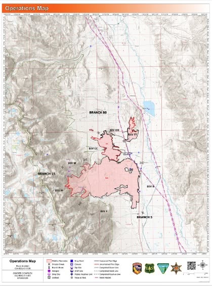
The #RockFire remains 12,008 acres and is now 74% contained. Control lines continue to be strengthened as firefighters continue to mop-up any areas of heat. Crews continue to work on suppression repair of firefighting activities.
The #CinderComplex remains 2,784 acres and is now 51% contained. Firefighters continue to strengthen control lines and mop-up remaining sources of heat.
Firefighting efforts are currently ongoing, even as roads re-open. The public is urged to use caution while driving in these areas. Drive with your lights on and use caution. Firefighting trucks are heavy and take longer stopping distances.
For the latest information on road closures and evacuation statuses, please visit Ready Inyo (https://ready.inyocounty.us/pages/rock-cinder ).
—
July 28, 6:30 PM
From Watch Duty:
The following changes to evacuations have been made for the Rock Fire/Cinder Complex. Updated zone statuses are visible on the Watch Duty map and the Genasys Evacuation Map.
Zone ICU-127 has been split into ICU-127-A & ICU-127-B. Zone ICU-127-B (Aberdeen) has been downgraded to a Evacuation Warning. ICU-127-A remains under an Evacuation Order.
The Evacuation Order for Zone ICU-131-C has been lifted.
Zone ICU-129 has been downgraded from an Evacuation Order to an Evacuation Warning.
Evacuation Warnings have been lifted for the following Zones: ICU-123-B, ICU-103, ICU-117-A, ICU-117-B, ICU-137-D, & ICU-123-A.
Per CAL FIRE BDU.
—
July 28, 11:20 AM
From Ready Inyo and Inyo County Sheriff’s Office:
ALERT NOTIFICATIONS PSA
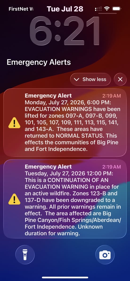
Monday afternoon, July 27, fiber optic lines were damaged by the Rock Fire/Cinder Complex, causing our emergency alert notifications to be sent out at different times throughout the day and night, depending on the cell phone carrier, user, and type of phones.
We sincerely apologize for the inconvenient alerts, and we appreciate your diligence in keeping up-to-date with what’s going on.
Please be advised: we will continue issuing daily renewals of the evacuation orders/warnings that remain in place due to legal requirement.
For the latest on Evac statuses, check the Genasys Protect App or website, or our Ready Inyo website:
Download the app: https://genasys.com/genasys-protect-app/
https://protect.genasys.com/en?lat=36.1716&lng=-115.1391…
https://ready.inyocounty.us/pages/rock-cinder
Additionally, you can call our fire information line at (760) 350-2747
—
July 28, 11:03 AM
From CAL FIRE:
As air operations continue on the Rock Fire and Cinder Complex, a Mobile Retardant Base has been established at Bishop Airport through a joint effort between the Inyo National Forest and CAL FIRE.
The base allows fixed-wing airtankers to quickly reload fire retardant close to the incident, significantly reducing turnaround times between drops. Instead of traveling longer distances to reload, aircraft can spend more time over the fire supporting firefighters on the ground.
While Bishop Airport has long been identified as a potential airtanker reload location, this marks the first time since the 2015 Round Fire that a mobile retardant base has been activated here for fixed-wing airtanker operations. Its return highlights the scale and complexity of the current incidents and the importance of bringing aviation resources as close to the fire as possible.
This collaborative effort between the Inyo National Forest and CAL FIRE strengthens the region’s aerial firefighting capabilities, improving operational efficiency and helping firefighters respond more effectively to rapidly changing fire conditions.

—
July 27, 6:16 PM
From Watch Duty:
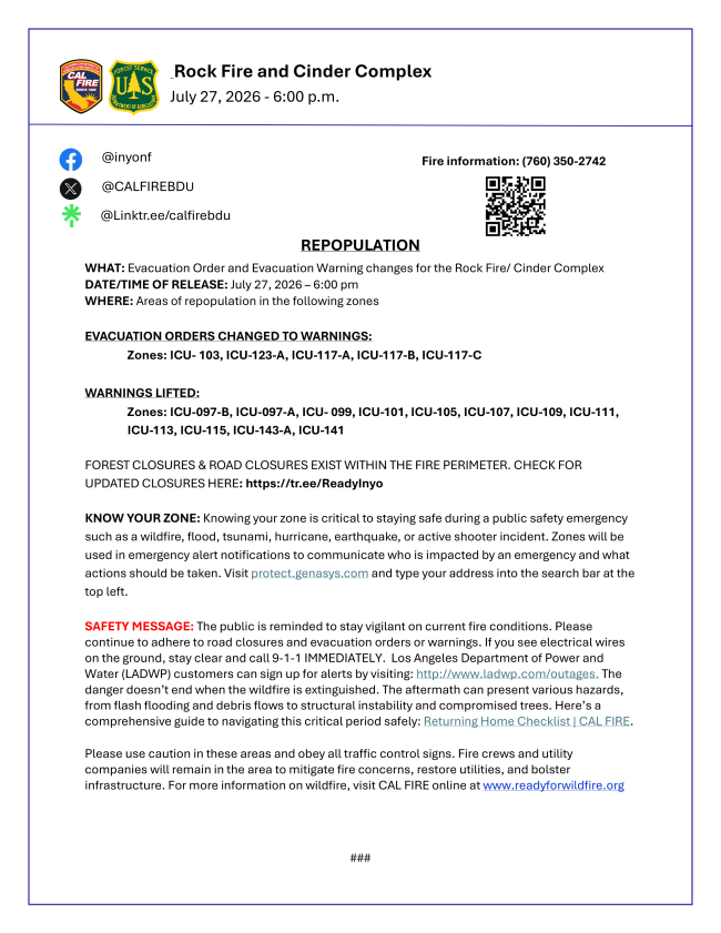
The following changes to evacuations have been made for the Rock Fire/Cinder Complex. Updated zone statuses are visible on the Watch Duty map and the Genasys Evacuation Map.
Evacuation Orders have been downgraded to Evacuation Warnings for the following Zones: ICU-103, ICU-117-A, ICU-117-B, ICU-117-C, ICU-123-A
Evacuation Warnings have been lifted for the following Zones: ICU-097-A, ICU-097-B, ICU-099, ICU-101, ICU-105, ICU-107, ICU-109, ICU-111, ICU-113, ICU-115, ICU-141, ICU-143-A
Forest closures & road closures exist within the fire perimeter. Check for updated closures at this link. Per CAL FIRE BDU.
—
July 28, 6:30 PM
From Watch Duty:
The following changes to evacuations have been made for the Rock Fire/Cinder Complex. Updated zone statuses are visible on the Watch Duty map and the Genasys Evacuation Map.
Zone ICU-127 has been split into ICU-127-A & ICU-127-B. Zone ICU-127-B (Aberdeen) has been downgraded to a Evacuation Warning. ICU-127-A remains under an Evacuation Order.
The Evacuation Order for Zone ICU-131-C has been lifted.
Zone ICU-129 has been downgraded from an Evacuation Order to an Evacuation Warning.
Evacuation Warnings have been lifted for the following Zones: ICU-123-B, ICU-103, ICU-117-A, ICU-117-B, ICU-137-D, & ICU-123-A.
Per CAL FIRE BDU.
—
5-4 Fire — July 28, 3:48 PM
From Watch Duty:
The fire has been mapped at 1,964.9 acres per the perimeter uploaded to the National Interagency Fire Center (NIFC), which is visible on the Watch Duty map under the Active Fire Perimeters map layer.
Note: Fire perimeters are preliminary and indicate general burn area but do not reflect structure protection efforts by firefighters. A structure within a fire perimeter may not be damaged or destroyed.
—
July 27, 6:16 PM
From Watch Duty:
The following changes to evacuations have been made for the Rock Fire/Cinder Complex. Updated zone statuses are visible on the Watch Duty map and the Genasys Evacuation Map.
Evacuation Orders have been downgraded to Evacuation Warnings for the following Zones: ICU-103, ICU-117-A, ICU-117-B, ICU-117-C, ICU-123-A
Evacuation Warnings have been lifted for the following Zones: ICU-097-A, ICU-097-B, ICU-099, ICU-101, ICU-105, ICU-107, ICU-109, ICU-111, ICU-113, ICU-115, ICU-141, ICU-143-A
Forest closures & road closures exist within the fire perimeter. Check for updated closures at this link. Per CAL FIRE BDU.
—
July 27, 6:05 PM
From CAL FIRE:
—
July 27, 12:52 PM
From CAL FIRE:
—
5-3 and 5-4 Fires — July 27, 12:21 PM
From Watch Duty:
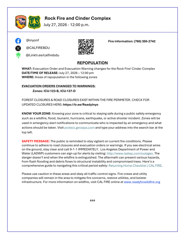
The Evacuation Order for Zone ICU-123-B has been downgraded to Warning.
This change may be viewed on the Watch Duty map or on Genasys Evacuation Map.
—
July 27, 12:06 PM
From Inyo County Sheriff’s Office:
Monday, July 27- 12 PM- Evacuation updates
The following evacuation zones will be downgraded from an EVACUATION ORDER to an EVACUATION WARNING:
ICU Zone 123-B- Big Pine Lakes, wilderness area
ICU Zone 137-D- NW of Fort Independence on the Westside of U.S. HWY 395
REMAINING EVACUATION ORDERS:
The following zones remain under EVACUATION ORDER due to ongoing safety hazards and continued assessments.
ICU Zones 103, 117-B, 123-A, 123-C, 123-D, 127, 129, and 131-C.
REMAINING EVACUATION WARNINGS:
The following areas remain under EVACUATION WARNING:
Community of Big Pine; ICU Zones 097-A, 097-B, 099, 101, 105, 107, 109, 111, 113, and 115; Fort Independence west of U.S. Highway 395 (ICU Zones 141 and 143-A).
Residents should monitor official updates and remain prepared for changing conditions.
Daily evacuation alerts may continue until ALL EVACUATION ORDERS and EVACUATION WARNINGS have been lifted.
For updated evacuation information or maps, please visit:
Genasys Protect: https://protect.genasys.com/…/37.143874%2C-118.418290…
WatchDuty: https://share.watchduty.org/i/110979?ts=1785176929000
Ready Inyo: https://ready.inyocounty.us/pages/rock-cinder
—
Cinder Complex — July 27, 6:14 AM
From Watch Duty:
The complex is now 35% contained, per CAL FIRE.
—
5-3 Fire — July 26, 10:40 PM
From Watch Duty:
The fire is 768 acres and is 28% contained. – per Southern Area Geographical Coordination Center Situation Report
—
5-4 Fire — July 26, 10:30 PM
From Watch Duty:
The fire is 2,016 acres and is 17% contained. – per Southern Area Geographical Coordination Center Situation Report
—
Cinder Complex — July 26, 7:01 PM
From Watch Duty:
The complex is 32% contained.
Current Situation: There could still be potential for growth under the right weather conditions. Firefighters continue mopping up hot spots and patrolling for smoke. Fire suppression repair is underway.
Weather: Drier air is settling in today and will persist through Monday, bringing a noticeable drop in humidity alongside a light breeze out of the south, with gusts capping out around 15 mph. No thunderstorm activity is forecasted through the start of the workweek, per the Inyo National Forest on Facebook.
—
Cinder Complex — July 26, 6:55 PM
From Inyo National Forest:
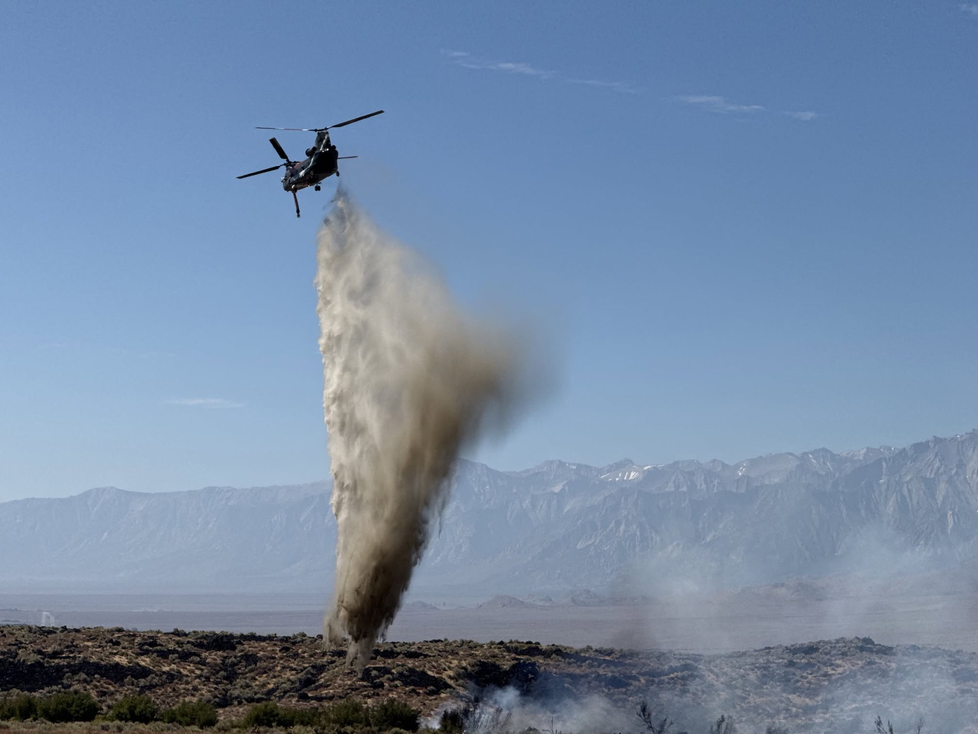
—
Cinder Complex — July 26, 6:06 PM
From Watch Duty:
The complex is now 30% contained, per CAL FIRE.
—
5-3 Fire — July 26, 3:00 PM
From Watch Duty:
The fire is 772.6 acres per the perimeter uploaded to the National Interagency Fire Center (NIFC), which is visible on the Watch Duty map under the Active Fire Perimeters map layer.
Note: Fire perimeters are preliminary and indicate general burn area but do not reflect structure protection efforts by firefighters. A structure within a fire perimeter may not be damaged or destroyed.
—
5-4 Fire — July 26, 3:00 PM
From Watch Duty:
The fire is 1,970.3 acres per the perimeter uploaded to the National Interagency Fire Center (NIFC), which is visible on the Watch Duty map under the Active Fire Perimeters map layer.
Note: Fire perimeters are preliminary and indicate general burn area but do not reflect structure protection efforts by firefighters. A structure within a fire perimeter may not be damaged or destroyed.
—
Cinder Complex — July 26, 12:59 PM
From Watch Duty:
The two fires in the Cinder Complex (5-3 and 5-4) have collectively been mapped at 2,783.8 acres by CAL FIRE Intel aircraft. Their perimeter is visible on the Watch Duty map under the Active Fire Perimeters map layer.
Note: Fire perimeters are preliminary and indicate general burn area but do not reflect structure protection efforts by firefighters. A structure within a fire perimeter may not be damaged or destroyed.
—
July 26, 11:00 AM
From newly elected Big Pine Paiute Tribe Chairperson Yolanda Cortez:
Many of you have received the evacuation warning notification this morning. This is not a change in status. Once an area is on notice to evacuate or to prepare to evacuate they are required to re-broadcast the same status every day. This is in case someone has moved into the area that wasn’t already here overnight.
We are still in the warning phase. Which is just prepare to evacuate. Part of the reason we remain in the warning phase is not so much due to the fire, but because of the amount of equipment as needed in the area to continue to fight the fire. We continue to monitor the fire progress daily and will provide updates as needed. We are so grateful for the firefighters and all the agencies out there keeping our community safe.
—
July 26, 10:43 AM
From Inyo County Sheriff’s Office:
Why Am I Receiving Repeated EVACUATION Alerts?
The Integrated Public Alert and Warning System (IPAWS) is the national emergency alert system used by public safety agencies to send Wireless Emergency Alerts (WEAs) to cell phones. IPAWS alerts automatically expire after 24 hours.
As long as EVACUATION ORDERS or EVACUATION WARNINGS remain in effect, they must be reissued every 24 hours to ensure anyone entering or traveling through affected areas receives current emergency information.
We are aware these periodic alerts are being received by multiple residents, including some outside the immediate affected areas.
Wireless Emergency Alerts are sent based on cell tower coverage areas, which may extend beyond exact evacuation boundaries.
Thank you for your patience and understanding.
For the most up-to-date information, please visit: https://ready.inyocounty.us/pages/rock-cinder
Genasys
https://protect.genasys.com/en/map/37.163122,-118.289512…

—
July 26, 7:50 AM
From Watch Duty:
July 26 Morning Update from CAL FIRE:
There was no growth on the Cinder Complex overnight. Heat remained along the outer perimeter of the fire. Engines and crews worked through the night patrolling the perimeter and cooling down hot spots.
Today, firefighters are focused on building and strengthening containment lines around the fire while continuing mop-up operations.
Weather: Expect southerly winds today through Monday with gusts reaching up to 15 mph, alongside dropping humidity levels. No thunderstorm activity is expected through Monday.
—
July 26, 6:24 AM
From Watch Duty:
The complex is now 25% contained, per CAL FIRE.
—
July 25, 7:59 PM
From Watch Duty:
Size: 2,722 acres | Containment: 15%
Firefighters made progress today, successfully establishing containment lines around portions of the Cinder Complex.
Weather: Hot and dry conditions persisted across the incident area today, accompanied by light winds. Temperatures are forecasted to cool down into the 70s overnight and then heat up into the triple-digits tomorrow with low relative humidity, per the Inyo National Forest on Facebook.
—
July 25, 7:42 PM
From Inyo National Forest:
#CinderComplex & #RockFire July 25th evening update
Cinder Complex
Location: Tinnemaha Road and Taboose Creek Road, North of Aberdeen, Inyo County, CA Size: 2,722
Unified Command: CAL FIRE, USFS, BLM and Inyo Sheriff
Percent contained: 15%
Cause: Lightning Start date: July 24, 2026
Rock Fire
Location: Black Rock Springs Road and Hwy 395, Poverty Hills, Inyo County, CA Size: 12,008
Unified Command: CAL FIRE, USFS, BLM and Inyo Sheriff
Percent contained: 40%
Cause: Under Investigation by CAL FIRE Law Enforcement
Start date: July 20, 2026
CURRENT SITUATION:
Firefighters made progress today, successfully establishing containment lines around portions of the Cinder Complex. On the Rock Fire, crews have initiated suppression repair operations along the southwest perimeter while Interagency Hotshot Crews have been air lifted into the northwest portion of the fire where they will remain over the next two nights, constructing direct control line on the fire’s edge through steep, remote, and inaccessible terrain.
WEATHER:
Hot and dry conditions persisted across the incident area today, accompanied by light winds. Temperatures are forecasted to cool down into the 70s overnight and then heat up into the triple-digits tomorrow with low relative humidity.
EVACUATION, SHELTER, AND CLOSURE INFORMATION:
Visit Ready Inyo https://tr.ee/ReadyInyo for the most current and up to date Road Closures, Shelter Locations and Evacuation information.
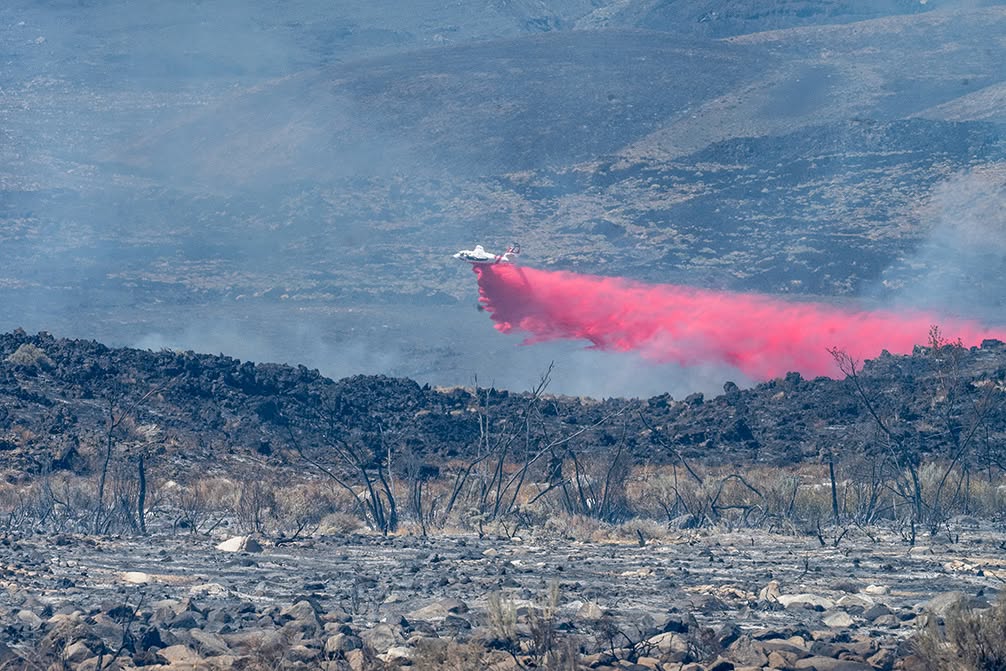
—
July 25, 5:46 PM
From Watch Duty:
The complex is now 15% contained, per CAL FIRE.
—
July 25, 4:04 PM
From Watch Duty:
The complex is now 2,722 acres, per CAL FIRE.
—
5-3 Fire — July 25, 4:01 PM
From Watch Duty:
The fire has been mapped at 767.8 acres by CAL FIRE Intel aircraft. Their perimeter is visible on the Watch Duty map under the Active Fire Perimeters map layer.
Note: Fire perimeters are preliminary and indicate general burn area but do not reflect structure protection efforts by firefighters. A structure within a fire perimeter may not be damaged or destroyed.
—
5-4 Fire — July 25, 3:26 PM
From Watch Duty:
The fire has been mapped at 1,954.3 acres by CAL FIRE Intel aircraft. Their perimeter is visible on the Watch Duty map under the Active Fire Perimeters map layer.
Note: Fire perimeters are preliminary and indicate general burn area but do not reflect structure protection efforts by firefighters. A structure within a fire perimeter may not be damaged or destroyed.
—
July 25, 8:25 AM
From Inyo National Forest:
#CinderComplex Morning Update – July 25, 2026
CURRENT SITUATION:
Early Friday evening just after 5:00 p.m., a thunderstorm cell created multiple lightning strikes near the Rock Fire burn area. Several new fires were ignited to the west and south of the Rock Fire, These incidents merged into two main fire footprints, designated as the 5-4 Fire and the 5-3 Fire.
The 5-4 Fire, located north of the Rock Fire, is actively burning in grass and brush toward Red Mountain and is anticipated to burn into the southern flank of the Rock Fire footprint. Firefighters, supported by successful night-flying, water-dropping aircraft along the toe of the slope, established a combination of dozer and handline around a large portion of the perimeter, despite severe access limitations caused by heavy rock formations. The primary operational priority today is to build containment around the 5-4 Fire, aggressively checking its north and west progression to prevent it from reaching the crest of the Sierra Nevada and the John Muir Wilderness.
The 5-3 Fire originated off Tinnemaha Road, south of Poverty Hills. Driven initially by southerly winds before shifting due to chaotic thunderstorm outflow winds, the fire pushed toward Highway 395. Ground crews successfully halted forward progress in the Poverty Hills area. While dozer line now surrounds the majority of the footprint, rocky terrain has delayed completion in some sectors, requiring hand crews to tie in the remaining uncontained line. Firefighters remain vigilant, as solar heating and erratic diurnal winds today may reactivate hot spots.
WEATHER:
Overnight firefighting conditions were generally favorable despite unseasonably warm temperatures, with a localized spot weather forecast recording 77° F under an inversion. Hand crews, dozers, and engines today will complete containment lines in the inaccessible areas, with maximum tactical priority assigned to holding the 5-4 Fire. Today, hot and dry weather will persist, with high temperatures holding in the low 100s daily. There is a 30 to 40 percent chance of afternoon thunderstorms today, which could generate gusty and erratic outflow winds.
EVACUATION, SHELTER, AND CLOSURE INFORMATION: Visit Ready Inyo https://tr.ee/ReadyInyo for the most current and up to date Road Closures, Shelter Locations and Evacuation information.
Fire information email: [email protected]
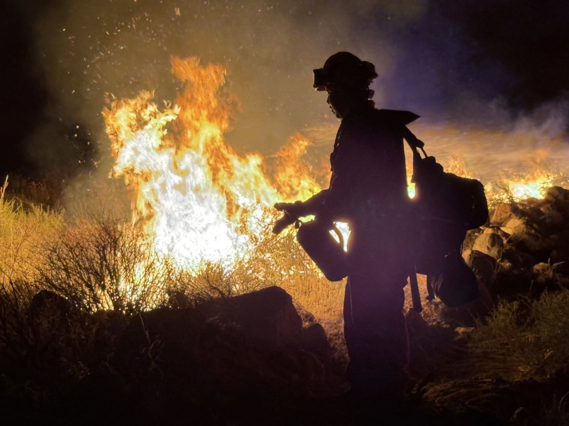
—
July 25, 8:03 AM
From Inyo County 4th District Supervisor Jen Roeser:
Great progress made during the night.
Appreciating all the efforts to contact residents in Big Pine Canyon!
As per usual- unsettled winds remain concern. The terrain is something else in these areas with dozers amazingly getting work done, much remains to hand crews and air support.
Speaking of hand crews – shout out to retired Cal Fire constituent in Round valley who quickly put a hand line around the lightning strike behind Vogets. Ranch people getting it done!
—
July 25, 6:58 AM
From Angeles National Forest:
Angeles NF Engine Strike Team 1605C is responding to assist CAL FIRE San Bernardino Inyo Mono Unit with the 2062-acre Cinder Complex Fire located north of Independence in Inyo County.
An engine strike team consists of five engines and a strike team leader.
More information regarding the Cinder Complex is available at: https://www.fire.ca.gov/incidents/2026/7/24/cinder-complex/
—
July 25, 4:34 AM
From Caltrans:
U.S. 395 southbound at North Fish Springs Road, south of Big Pine, is OPEN.
The roadway was previously closed due to smoke and thunderstrikes that caused new fire activity north of the #RockFire.
CAL FIRE has named this new fire activity the Cinder Complex.
If traveling through the area please stay alert for CAL FIRE San Bernardino/Inyo/Mono Unit and other emergency personnel close to the roadway.
For more information about the status of the #RockFire or #CinderComplex, visit Ready Inyo at https://ready.inyocounty.us/ or https://www.fire.ca.gov/incidents/2026/7/20/rock-CALFIRE
For updates on road conditions and closures, visit https://quickmap.dot.ca.gov/
—
Cinder Complex — July 24, 10:56 PM
From Watch Duty:
The complex is now 2,062 acres, per the National Interagency Fire Center (NIFC).
—
5-3 Fire — July 24, 10:55 PM
From Watch Duty:
The fire has been mapped at 744.7 acres by FIRIS OES Intel 24. Their perimeter is visible on the Watch Duty map under the Active Fire Perimeters map layer.
Note: the pin on the Watch Duty map has been moved 0.95 miles to the Northwest.
Note: Fire perimeters are preliminary and indicate general burn area but do not reflect structure protection efforts by firefighters. A structure within a fire perimeter may not be damaged or destroyed.
—
5-4 Fire — July 24, 10:21 PM
From Watch Duty:
The fire has been mapped at 1,318.3 acres by FIRIS OES Intel 24. Their perimeter is visible on the Watch Duty map under the Active Fire Perimeters map layer.
Note: Fire perimeters are preliminary and indicate general burn area but do not reflect structure protection efforts by firefighters. A structure within a fire perimeter may not be damaged or destroyed.
—
July 24, 10:05 PM
From Inyo County Sheriff’s Office and Ready Inyo:
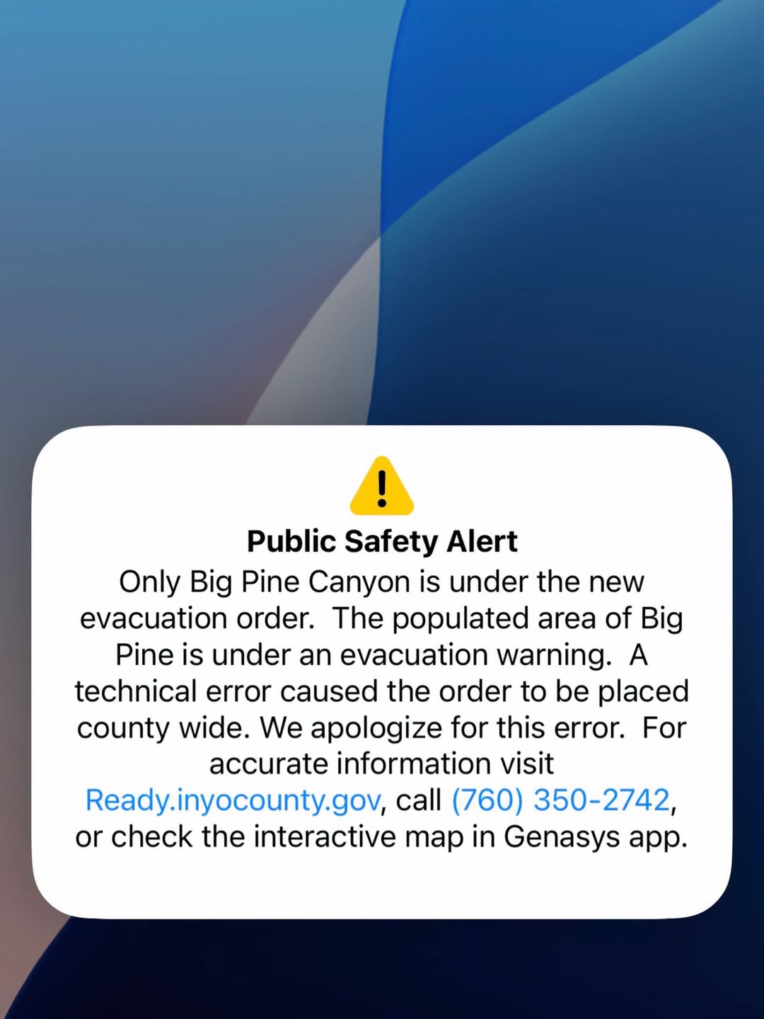
Inyo County accidentally sent out a county-wide evacuation order. Some alerts went outside Inyo County as well. This was a technical error and we apologize for creating unnecessary concern.
Due to the “Cinder Complex” resulting from lightning fires today, the community of Big Pine is currently under an evacuation WARNING, and Big Pine Canyon/recreation area is under an ORDER.
Should these warnings get upgraded to ORDERS, Big Pine Fire will sound the station fire alarm 3 consecutive times.
There are additional evacuations that remain in place for the Rock Fire.
For accurate information, visit Ready.inyocounty.us, call (760) 350-2742 or check the interactive map in the Genasys app.

—
5-4 Fire — July 24, 10:12 PM
From Watch Duty:
The fire has been mapped at 1,318.3 acres by FIRIS OES Intel 24. Their perimeter is visible on the Watch Duty map under the Active Fire Perimeters map layer.
Note: Fire perimeters are preliminary and indicate general burn area but do not reflect structure protection efforts by firefighters. A structure within a fire perimeter may not be damaged or destroyed.
—
July 24, 9:51 PM
From CHP:
TRAFFIC UPDATE
CHP is currently escorting southbound traffic from North Fish Spring Road to the South Aberdeen area.
Motorists should expect delays and use caution while traveling through the area. Please follow directions from CHP and assisting personnel.
—
July 24, 8:50 PM
From CHP:
ROAD CLOSURE ALERT
Due to wildfire activity in the area, US-395 southbound is CLOSED at North Fish Springs Road.
Motorists are reminded to follow all traffic control devices and directions from emergency personnel. Do not attempt to bypass road closures.
—
July 24, 8:42 PM
From Inyo County Wildfire Incidents:
7/24/26 Vegetation Fire Cinder Complex Fire Tinnemaha Road x Taboose Creek Road, North of Aberdeen, Inyo County. (5-3 Fire and 5-4 Fire now known as the Cinder Complex Fire) [Cal Fire BDU picture]
4:19PM CAL FIRE San Bernardino/Inyo/Mono Unit U.S. Forest Service – Inyo National Forest Bureau of Land Management Inyo County Sheriff’s Office units are at scene and responding to multiple vegetation fires in the area. The fire is currently estimated to be 1,000 acres and 0% contained. The Cinder Complex Fire started Friday afternoon as the result of lightning strikes near the perimeter of the Rock Fire. The Cinder Complex Fire is made of up multiple lighting strike fires and is being managed by the same team as the Rock Fire due to proximity and available resources.
EVACUATIONS:
*Evacuation Orders:
Immediate threat to life. This is a lawful order to LEAVE NOW. The area is lawfully closed to public access.
ICU-123-B, ICU-103, ICU-117-A, ICU-117-B, ICU-123-A, ICU-123-C, ICU-123-D, ICU-127, ICU-129, ICU-131-C, and ICU-137-D.
*Evacuation Warnings:
Potential threat to life and/or property. Those who require additional time to evacuate, and those with pets and livestock should leave now.
ICU-099, ICU-113, ICU-115, ICU-109, ICU-107, ICU-105, ICU-097-A, ICU-143-A, ICU-141, ICU-101, and ICU-111.
SCANNER: Inyo County Sheriff, Fire and EMS, CHP Gold broadcastify
—
July 24, 8:14 PM
From CAL FIRE:
[NEW INCIDENT] Vegetation Fire – Lightning Complex
4:19 p.m. 7/24/26 – Tinnemaha Road x Taboose Creek Road, North of Aberdeen, Inyo County, CA
CAL FIRE San Bernardino/Inyo/Mono Unit U.S. Forest Service – Inyo National Forest Bureau of Land Management Inyo County Sheriff’s Office units are at scene and responding to multiple vegetation fires in the area. The fire is currently estimated to be 1000 acres and 0% contained. Please follow Ready Inyo for evacuation information.

—
July 24, 8:06 PM
From Bishop Police Department:
Public Service Announcement
The City of Bishop is aware that many residents received an emergency evacuation alert on their mobile phones.
At this time, there are NO evacuation orders or evacuation warnings in effect for the City of Bishop.
The alert appears to have been intended for areas of Inyo County that are currently under evacuation orders but was inadvertently distributed to the Bishop area.
Please do not evacuate unless you receive official instructions that specifically apply to your location. We encourage everyone to rely on official sources for the most current and accurate emergency information.
We understand this alert caused confusion and appreciate your patience. We will share updates if any new information becomes available.
Please help us reduce confusion by sharing this post.
—
July 24, 8:00 PM
From Inyo County Sheriff’s Office:
The alert for Bishop, Round Valley, and Paradise is an error. Do NOT evacuate Bishop. Please visit https://protect.genasys.com/…/37.143874%2C-118.418290… or WatchDuty https://share.watchduty.org/i/110980?ts=1784948193000 for a map of red order zones that need to evacuate and yellow evacuation zones that are listed as warnings.


—
Cinder Complex — July 24, 8:34 PM
From Watch Duty:
Resources are on scene and responding to multiple vegetation fires in the area as part of the Cinder Complex, per CAL FIRE BDU on X. The complex is currently estimated to be 1000 acres and 0% contained.
For individual updates, including information about evacuations, refer to the 5-3 Fire and 5-4 Fire incidents on Watch Duty.
—
July 24, 8:31 PM
From Inyo County Sheriff’s Office:
UPDATE: 08:31 PM- IF Big Pine goes into a EVACUATION ORDER, Big Pine Volunteer Fire Department will sound the fire alarm 3 times. At this time Big Pine is under a WARNING.
EVACUATION ORDERS/ WARNINGS
Evacuation ORDERS are in effect for the following ICU Zones:
ICU Zone 103
ICU Zone 117-A
ICU Zone 117-B
ICU Zone 123-A
ICU Zone 123-B
ICU Zone 123-C
ICU Zone 123-D
ICU Zone 127
ICU Zone 129
ICU Zone 131-C
ICU Zone 137-D
Evacuation WARNINGS are in effect for the following ICU Zones:
ICU Zone 097-A
ICU Zone 097-B
ICU Zone 099
ICU Zone 101
ICU Zone 105
ICU Zone 107
ICU Zone 109
ICU Zone 111
ICU Zone 113
ICU Zone 115
EVACUATION CENTER:
Bishop Senior Center
682 Spruce St, Bishop, CA 93514
Livestock:
Tri County Fairgrounds
475 Sierra St, Bishop, CA 93514 (Mule Days gate – Main Street entrance)
Road Closure:
Highway 395 southbound is closed starting at North Fish Springs Road going south.
Evacuation information:
https://ready.inyocounty.us/pages/rock-fire
Watch Duty
https://app.watchduty.org/i/110980
Genasys: With Map and color coded zones
https://protect.genasys.com/…/37.163122%2C-118.289512…
5-3 & 5-4 Fire UPDATE / ROAD CLOSURE
Personnel are responding
Please avoid the area and do not attempt to bypass road closures. Updates will be provided as conditions change.
—
5-4 Fire — July 24, 8:03 PM
From Watch Duty:
An Evacuation Center has been set up at Bishop Senior Center, 682 Spruce Street, Bishop, CA 93514, per CAL FIRE.
Several new fires started on the north end of the Rock Incident in the Red Mountain area. The largest of these starts grew to an estimated 200 acres; however, all activity remains west of Highway 395. Firefighters will work through the night to construct containment lines around these new starts. All fire activity remains within established geographic incident objectives.
High temperatures in the low 100s will produce severe heat conditions, further hindering fire suppression efforts. Additional thunderstorms forecast for Saturday afternoon may pose further safety hazards to personnel and impede line construction. – per CAL FIRE BDU on Facebook.
—
5-3 Fire — July 24, 7:51 PM
From Watch Duty:
Evacuation Orders have been issued for Zones ICU-103 & ICU-123-B on the Genasys Evacuation Map. This is an upgrade from their previous warning status. These zones are also visible on the Watch Duty map.
Several new fires started on the north end of the Rock Incident in the Red Mountain area. The largest of these starts grew to an estimated 200 acres; however, all activity remains west of Highway 395. Firefighters will work through the night to construct containment lines around these new starts. All fire activity remains within established geographic incident objectives.
High temperatures in the low 100s will produce severe heat conditions, further hindering fire suppression efforts. Additional thunderstorms forecast for Saturday afternoon may pose further safety hazards to personnel and impede line construction. – per CAL FIRE BDU on Facebook.
—
5-4 Fire — July 24, 7:48 PM
From Watch Duty:
Evacuation Orders have been issued for Zones ICU-103 & ICU-123-B on the Genasys Evacuation Map. This is an upgrade from their previous warning status. These zones are also visible on the Watch Duty map.
—
July 24, 7:35 PM
From CAL FIRE:
Around 3 p.m. today, thunderstorm cells moved over the Rock Fire, generating multiple lightning strikes and strong downdrafts that forced several crews to shelter in place.
The lightning activity ignited several new fires on the north end of the incident in the Red Mountain area. The largest of these starts grew to an estimated 200 acres; however, all activity remains west of Highway 395. Firefighters will work through the night to construct containment lines around these new starts. All fire activity remains within established geographic incident objectives.
Earlier in the day, firefighters made steady progress, constructing additional hand line along portions of the fire, including the southern flank. A helitack crew was inserted into the western sector to build containment line, but incoming afternoon thunderstorms forced an evacuation of the area for crew safety. On the northeastern flank, the main fire held within existing containment lines.
High temperatures in the low 100s will produce severe heat conditions, further hindering fire suppression efforts. Additional thunderstorms forecast for Saturday afternoon may pose further safety hazards to personnel and impede line construction.

—
5-4 Fire — July 24, 7:22 PM
From Watch Duty:

An additional 2 night-flying copters and 1 night-flying helicopter coordinator have been requested. – per radio traffic
View fire on on the Great Basin Unified Air Pollution Control District “Valley North” camera image above.
—
5-3 Fire — July 24, 7:22 PM
From Watch Duty:
View fire on on the Great Basin Unified Air Pollution Control District “Valley North” camera image above.
—
July 24, 7:15 PM
From Ready Inyo:
NEW FIRE ACTIVITY: EVACUATION WARNINGS ISSUED FOR BIG PINE
Friday, July 24 at 6:55 PM
With the increased thunderstorm and lightning activity this afternoon, several new fires started just north of the #RockFire, prompting Evacuation Warnings for the town of Big Pine and Big Pine Creek area.
“Get Ready” to evacuate zones:
97-A and B, 99, 101, 103, 105, 107, 109, 111, 113, 115, and 123-B
Folks with large animals should EVACUATE NOW
Evac center: Tri-County Fairgrounds (Mule Days gate – Main Street entrance)
Highway 395 southbound is closed starting at North Fish Springs Road going south.
For more evacuations info, follow Inyo County Sheriff’s Office or visit: https://ready.inyocounty.us/pages/rock-fire
Photos courtesy of the Big Pine Fire Department


—
5-3 Fire — July 24, 7:10 PM
From Watch Duty:
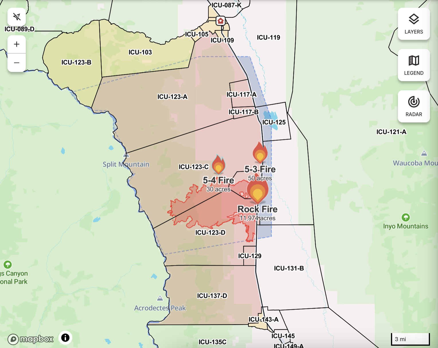
Evacuation Warnings have been issued for the following Zones: ICU-097-A, ICU-097-B, ICU-099, ICU-101, ICU-103, ICU-105, ICU-107, ICU-109, ICU-111, ICU-113, ICU-115, and ICU-123-B. Per the Genasys Evacuation Map. These zones are also visible on the Watch Duty map.
An additional 2 night-flying copters, 1 night-flying helicopter coordinator, 1 large air tanker (LAT), and 1 lead plane have been requested by air attack. A total of 5 air tankers are currently responding.
Note: The zones previously under evacuation orders on the Rock Fire have been added to this incident.
—
5-4 Fire — July 24, 7:05 PM
From Watch Duty:
Evacuation Warnings have been issued for the following Zones: ICU-097-A, ICU-097-B, ICU-099, ICU-101, ICU-103, ICU-105, ICU-107, ICU-109, ICU-111, ICU-113, ICU-115, and ICU-123-B. Per the Genasys Evacuation Map. These zones are also visible on the Watch Duty map.
An additional 1 large air tanker (LAT) has been requested by air attack. A total of 5 air tankers are currently responding.
Note: The zones previously under evacuation orders on the Rock Fire have been added to this incident.
—
5-4 Fire — July 24, 6:46 PM
From Watch Duty:
30 to 40 acre vegetation fire in the area, per incident command ≈30 minutes ago. Air resources are responding.
An additional 2 fires in the area are burning downhill to the east towards the 5-4 Fire.
Note: Location is approximate and subject to change.
—
5-3 Fire — July 24, 6:46 PM
From Watch Duty:

The fire is 50+ acres and it is bumping Highway 395. California Highway Patrol has closed the road in the area. – per radio traffic 30 minutes ago
Note: the location of the Watch Duty map is approximate and may be subject to change.
View fire on attached camera above.
Discover more from Eastern Sierra Now | Local News
Subscribe to get the latest posts sent to your email.